
Field guide
Offline Maps
Download the ground you plan to work while you still have signal. In the field, the map runs off your phone with no service at all.
- Every layer downloads, including LiDAR
- About 28MB per square mile cell
- No signal needed once it is saved
What downloads
Every layer, not just the basemap.
- Satellite imagery
- Both LiDAR hillshades
- All three historic topo bands
- Property lines
- Active and closed mining claims
- Public lands
Step by step
-
Step 1 of 4
Open Offline Maps
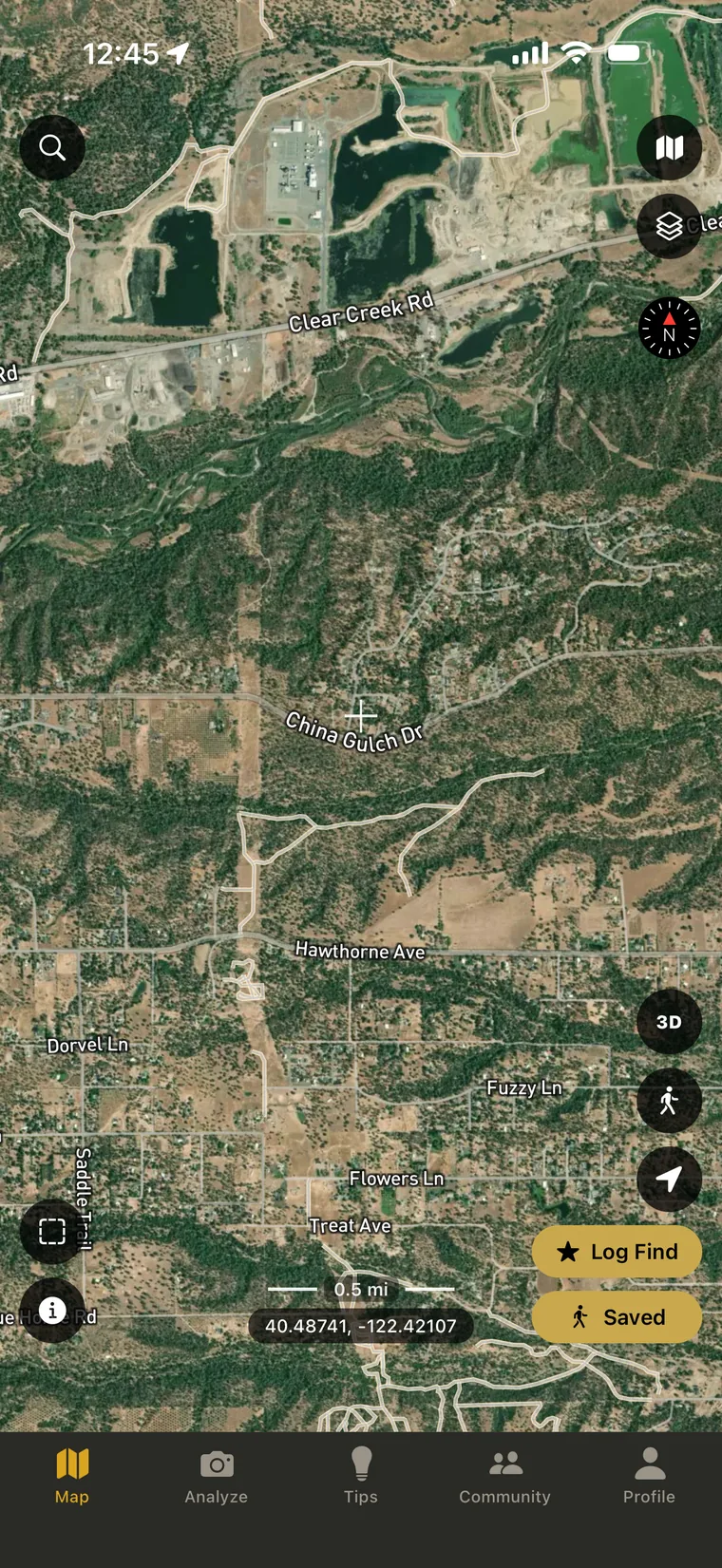
On the map screen, tap the offline maps button. It is the dashed square in the lower left, above the info button.
-
Step 2 of 4
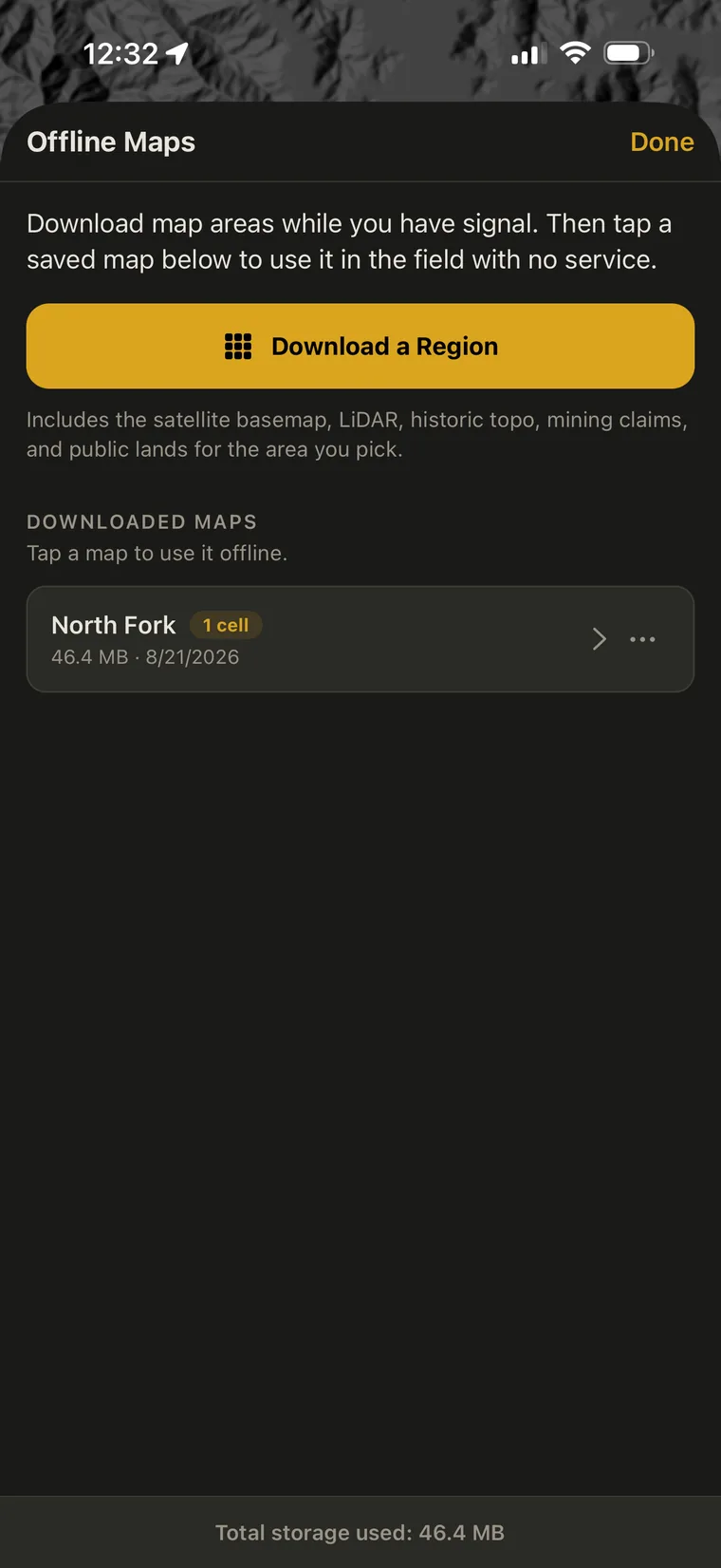
Tap Download a Region
Saved areas are listed underneath, along with the storage they use. This screen is also where you come back to activate one later.
-
Step 3 of 4
Pick your cells and download
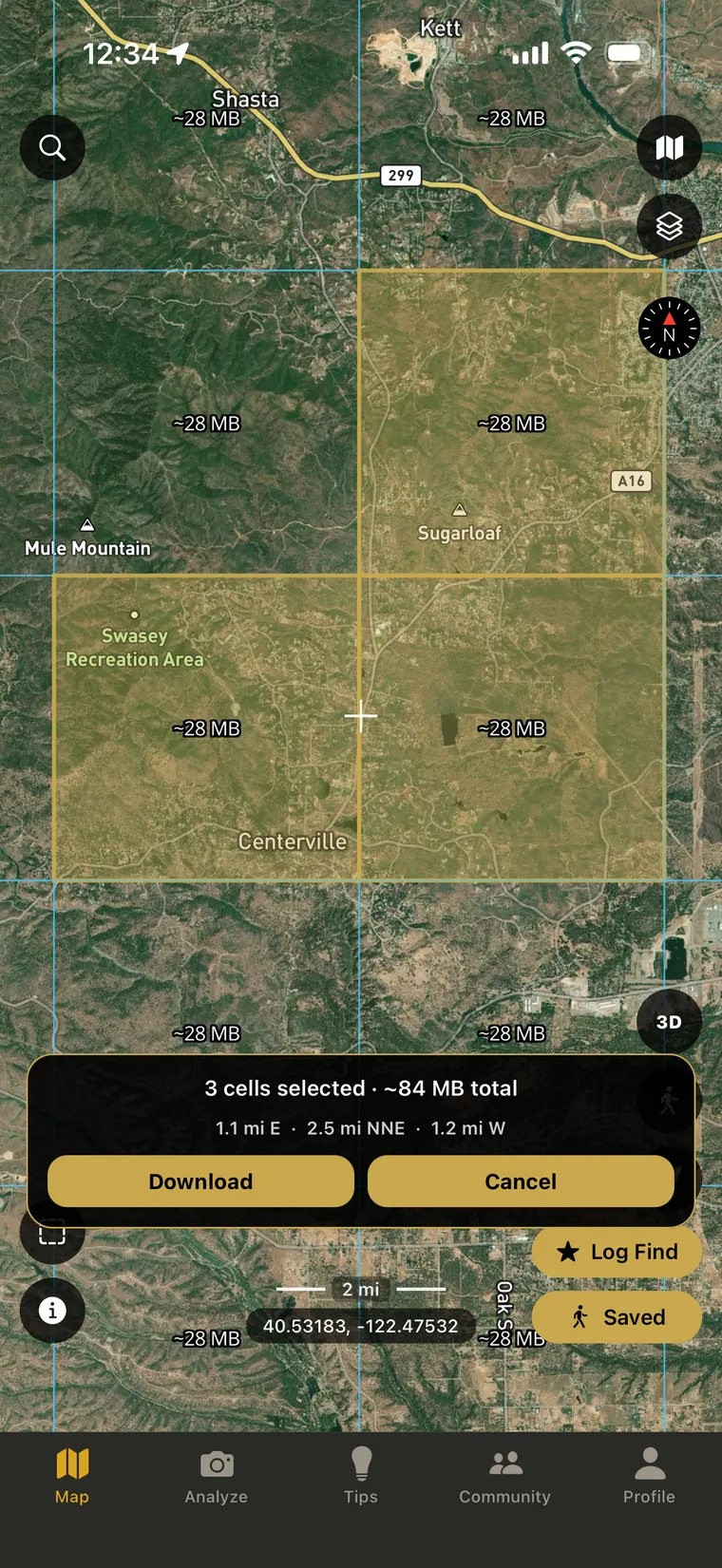
Zoom in until the grid appears. It only shows at closer zoom levels, because each cell is about a mile across. Tap the cells covering the ground you plan to work, then hit download and give it a name.
Budget about 28MB per cell. Keep the app open and the screen on until it finishes. If you background the app or the screen locks, the download stops.
-
Step 4 of 4
Tap the saved map to use it
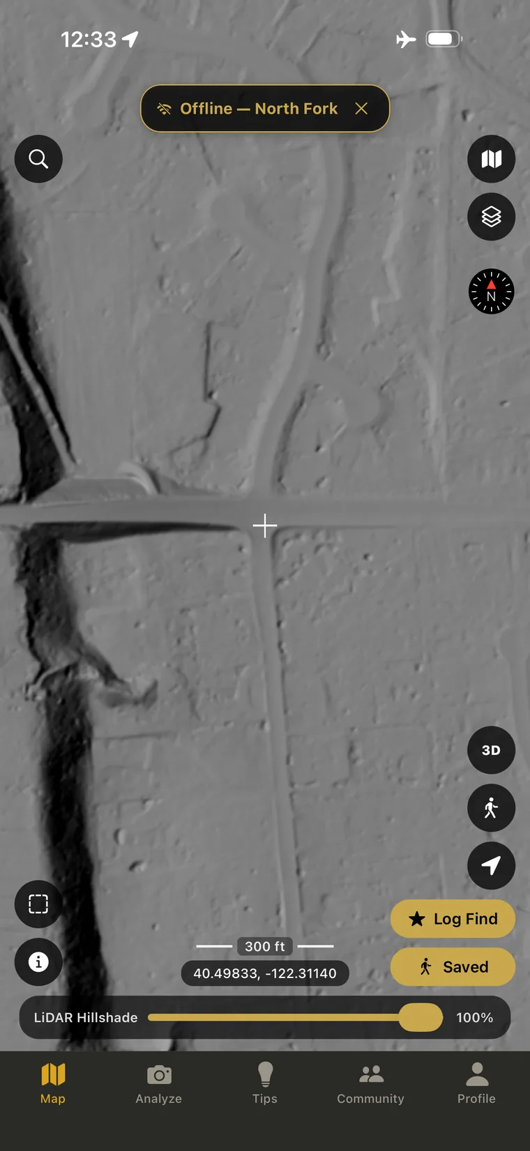
Open Offline Maps and tap the map you saved. The banner at the top tells you which area is active, and the map draws only from what you downloaded.
That phone is in airplane mode. No signal at all, and the LiDAR still renders. Tap the X on the banner to go back to the live map.
Downloading is only half of it
A downloaded area does nothing on its own. You have to open Offline Maps and tap the saved map before the app will use it.
If there is no banner at the top, you are still on the live map and still waiting on a network that is not there.
Knowing where your coverage ends
Inside offline mode, panning past the edge of what you downloaded shows nothing. That is how you tell where your coverage stops.
Wifi or cell service
Wifi is best, and it is the fastest way to pull down a few cells. It will also download over regular cell service, so being away from the house does not stop you.
Either way, do it before you lose signal. The trailhead with one bar is not where you want to start a download.
Managing saved areas
Downloaded areas can be renamed and deleted. The screen shows total storage used.