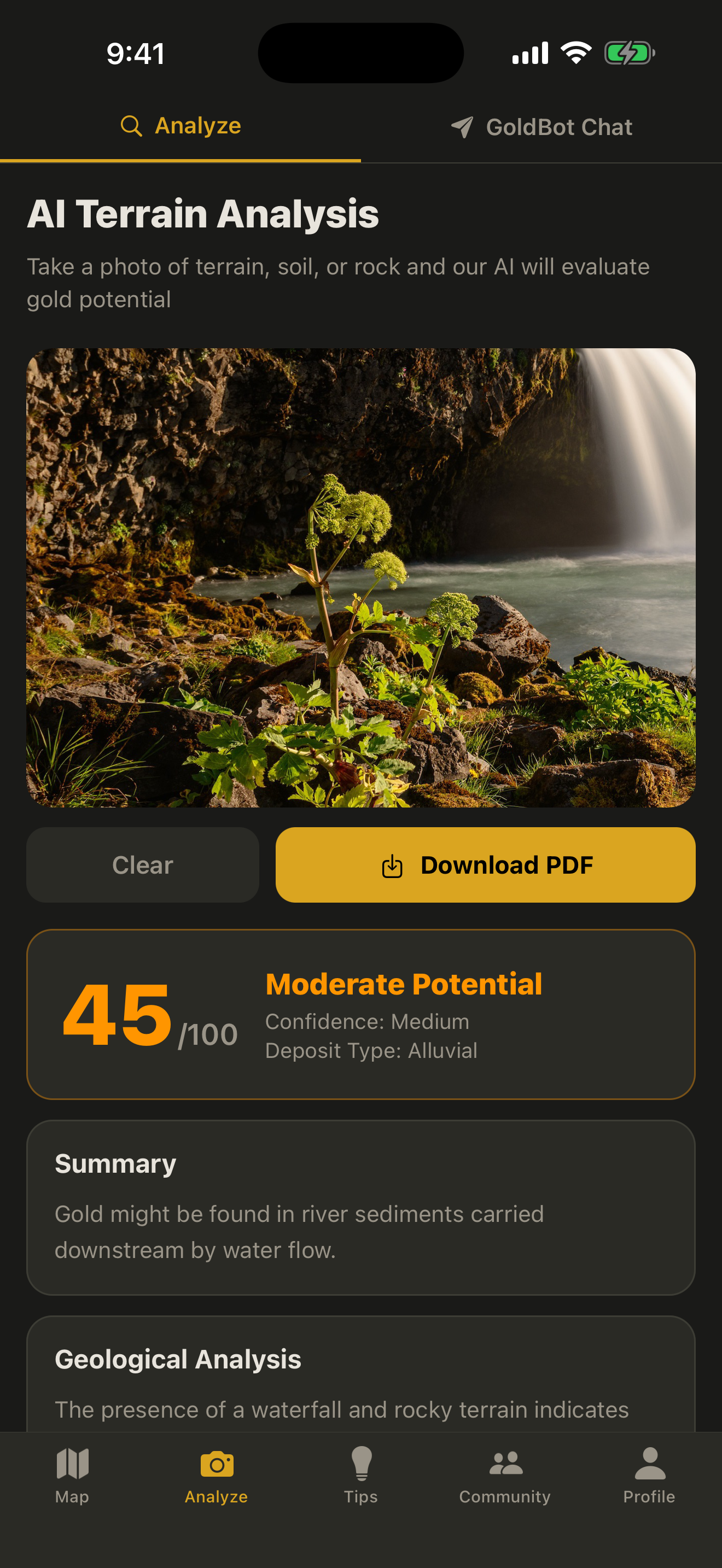
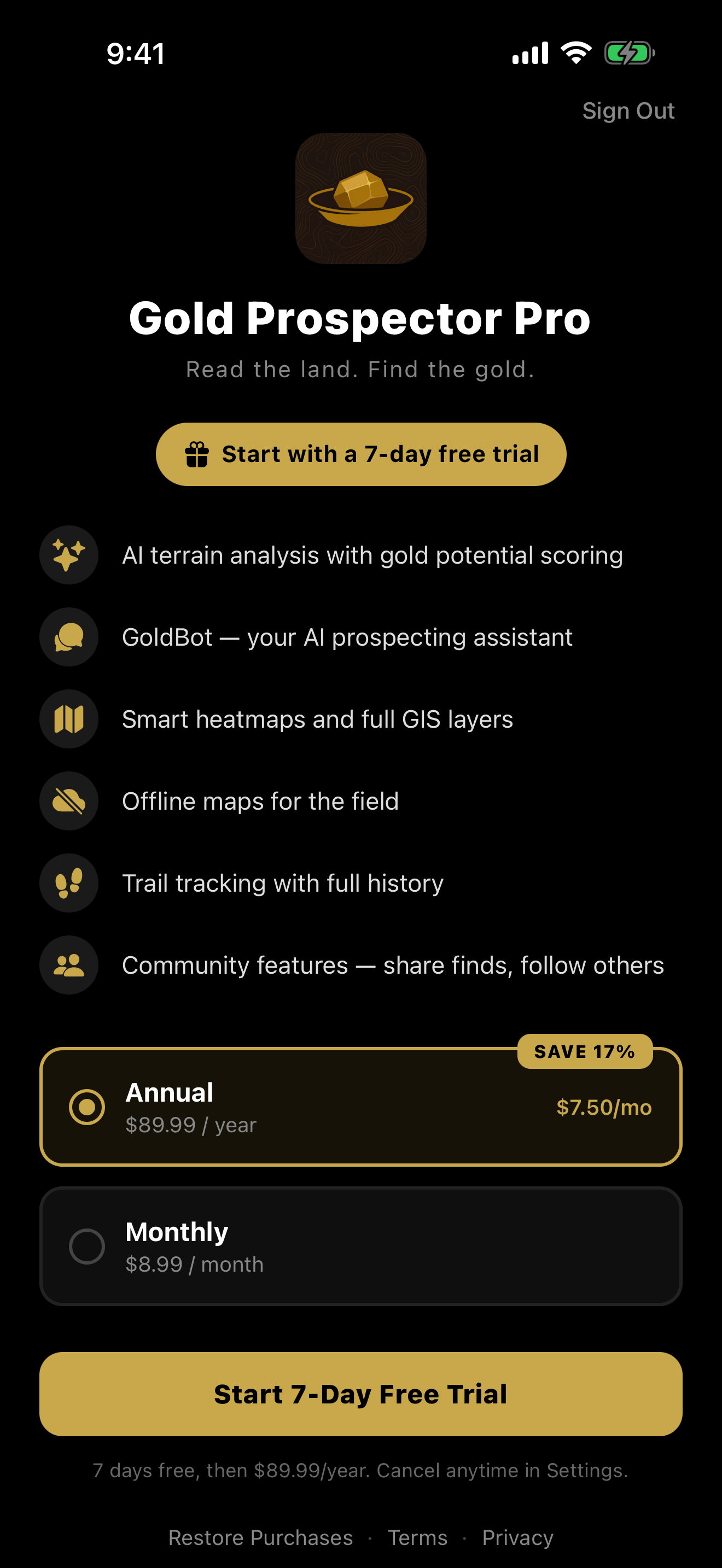
AI Terrain Analysis
Trained strictly for gold prospecting. Snap a photo of a creek, cut bank, or hillside — get a 0–100 score with confidence level. The model identifies rock types, calls out mineral indicators (iron staining, quartz veins, black sand), reads water flow for gold trap potential, names the deposit type (placer, alluvial, hardrock, eluvial), and tells you where in the frame to start sampling. Plain-English explanations included.
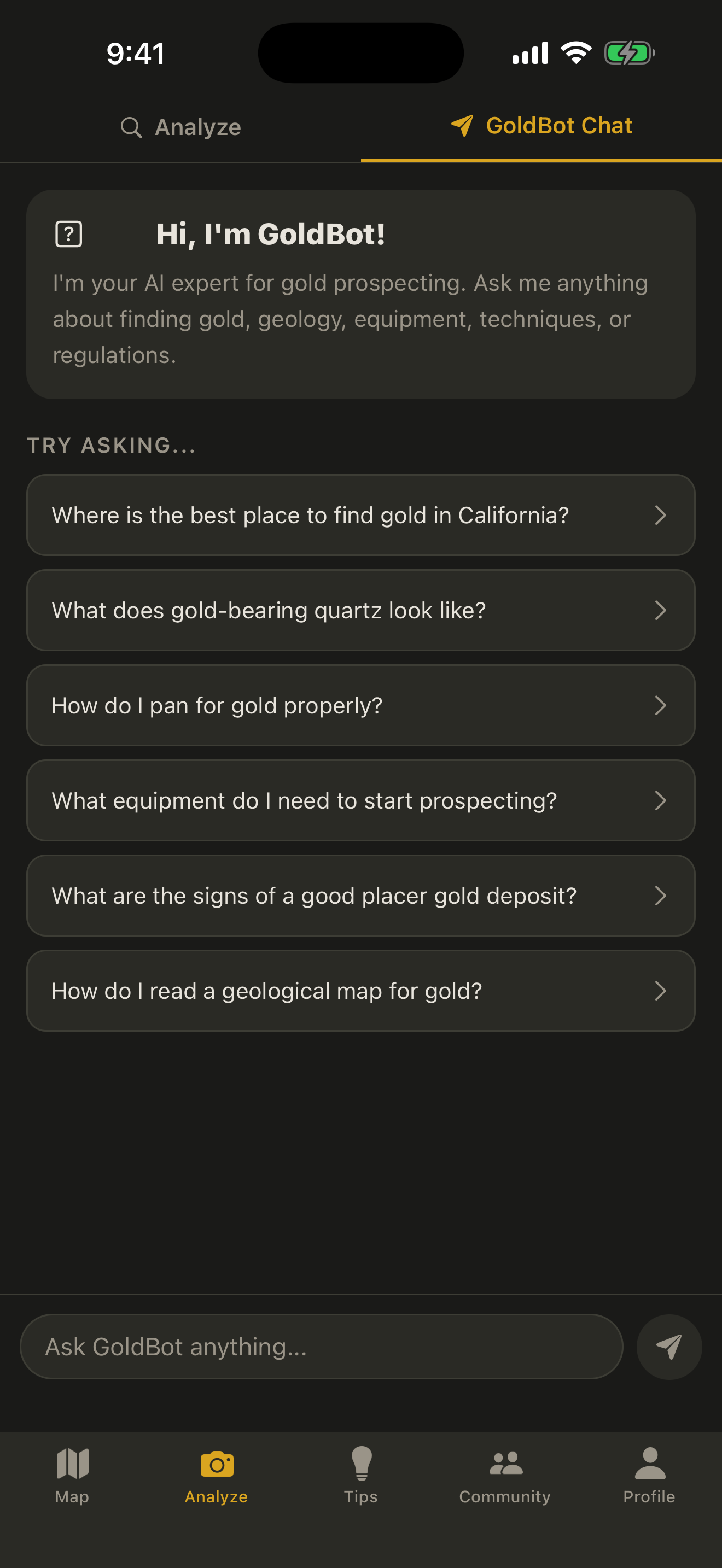
GoldBot
Your AI prospecting buddy. Ask about geology, gear, technique, panning, sluicing, or whether that black sand is worth a second look. Trained on 30+ years of placer and lode prospecting knowledge — not search engines.
LiDAR Layer
See the bones of the land. Old foundations, abandoned roads, ditch lines, dredge tailings, and earthworks invisible from the surface. Advanced LiDAR experience in active development.
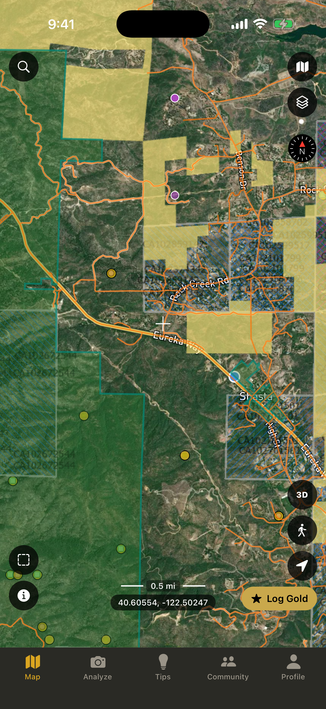
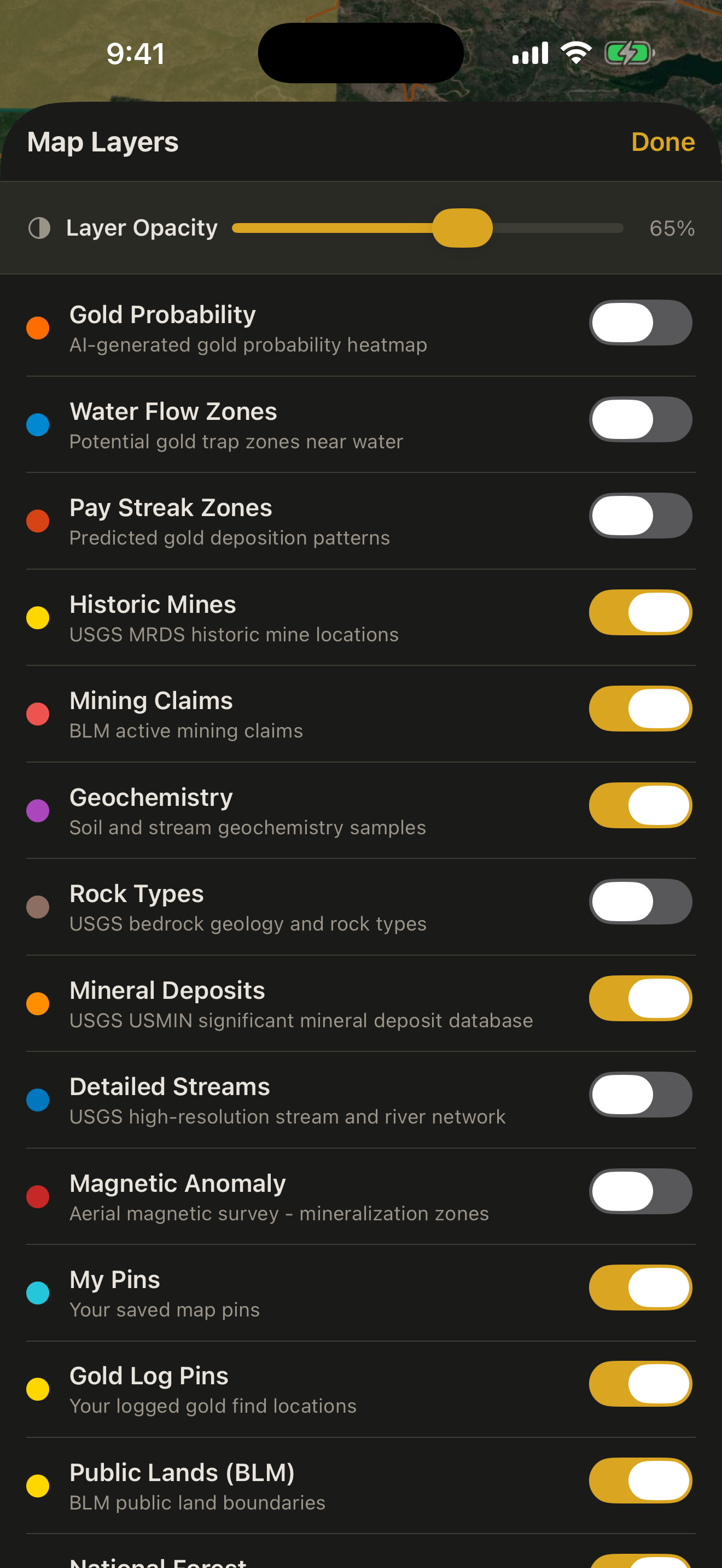
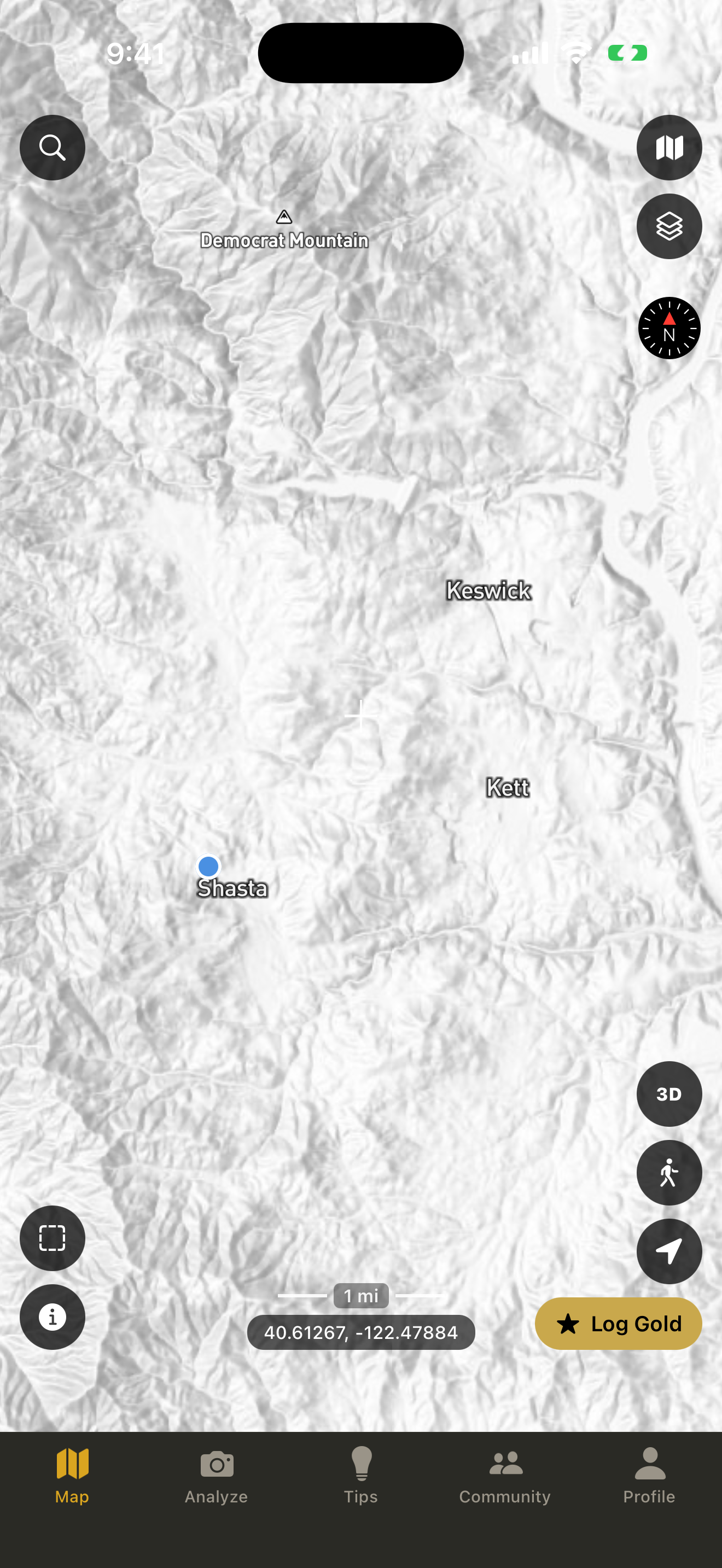
Maps Built for Finders
Mapbox satellite, topo, geology, and public-lands layers. See claims, property lines, and access. Drop pins on cuts, riffles, foundations, and old workings. Download regions for offline backcountry use.
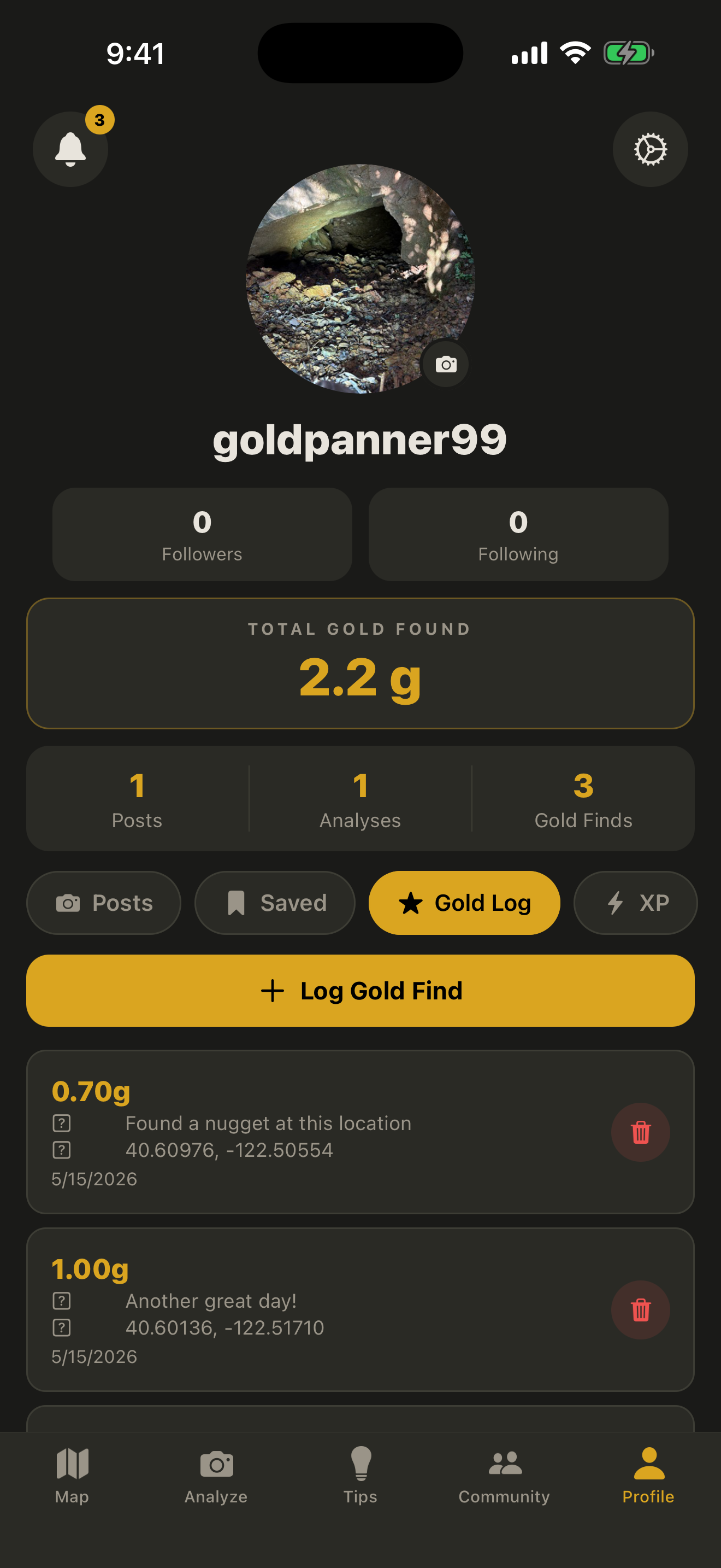
Track Every Trip & Find
Record routes, mark finds, log your hours. Plus a private gold log: every find with weight (grams or ounces), location, and notes — pinned on your map, never public. Watch your totals grow over time. XP tracks your posts, analyses, and gold logged.
Tips & News
Curated guides for beginners, deeper field technique for veterans, and news from the prospecting world. Hand-picked, no algorithmic clutter.
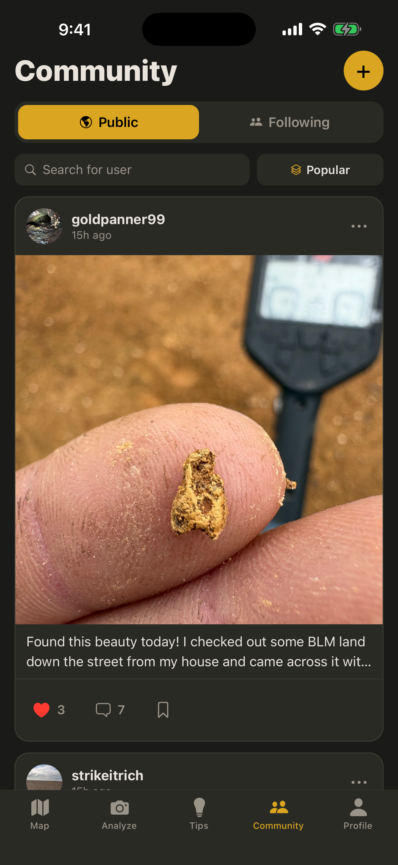
A Community That Gets It
Share finds, follow people who've been working their patches for decades, swap technique. Prospectors and detectorists welcome. Moderated to keep it useful.
Yours to Keep
Locations and finds are private by default. Share what you want, hide what you don't. Honey holes and permission spots stay yours.