
About a 10 minute read. Rules change — always confirm with the managing agency before you go. Sources are linked throughout and listed at the bottom.
Northern California is still one of the best places in the country to find gold with nothing more than a pan and patience. The same rivers that kicked off the Gold Rush in 1848 — the American, the Yuba, the Trinity, and the creeks that feed them — keep replenishing their gravels every winter as high water tears new material loose and drops it behind boulders and on inside bends.
The hard part for most new prospectors isn't finding gold. It's knowing where you're allowed to look. Between active mining claims, withdrawn lands, state park rules, and a statewide dredging ban, it's easy to end up somewhere you shouldn't be without realizing it.
This guide covers seven places in Northern California where recreational gold panning is explicitly legal on public land, what the rules are at each one, and what kind of gold you can realistically expect. Every claim about legality below links to the managing agency — not a forum post.
First, the ground rules
Three things keep you legal almost everywhere in California:
- Hand tools only, and sometimes hands-and-pans only. California banned suction dredging statewide, and most State Park units restrict you to a gold pan and your bare hands — no shovels, picks, or sluices. Federal land is generally more permissive about hand tools, but motorized equipment requires authorization.
- Check for mining claims. Much of the best ground on BLM and National Forest land is under active claim. Panning on someone's claim without permission is mineral trespass. The Forest Service treats panning and metal detecting as prospecting under the General Mining Law of 1872, and puts the responsibility on you to verify claim status before you dig.
- Designated areas are your friend. The spots below are designated or explicitly open for recreational panning, which removes most of the guesswork. They're the right place to start.
1. Whiskeytown National Recreation Area (Shasta County)
Whiskeytown, just west of Redding, is one of only two places in the entire National Park system where recreational gold panning is allowed — written directly into federal regulation.
You'll need a Whiskeytown gold panning permit, which costs one dollar and is valid for a full year, plus a park entrance pass. Both are available at the Visitor Center or online. Unlike most California panning spots, Whiskeytown lets you use a small trowel or spoon (blade no bigger than 4 by 8 inches) alongside your pan — but metal detectors, sluices, dredges, and any mechanical equipment are prohibited.
Metal detecting: Not allowed at Whiskeytown. The park restricts you to gold pans and hand tools only. No metal detectors permitted.
The classic spots are the Tower House Historic District, where Mill Creek, Crystal Creek, and Clear Creek come together amid Gold Rush–era structures, and the Clear Creek Picnic Area on Trinity Mountain Road. Clear Creek drains country that was mined hard in the 1850s, and fine flood gold keeps moving through it. Expect fine gold and small flakes rather than nuggets — and a genuinely beautiful place to spend a day.
2. The Trinity River corridor (Trinity County)
The Klamath Mountains are the second most productive gold province in California after the Mother Lode, and the Trinity River is its backbone. The most productive placer deposits in the region have historically been along the Trinity and Klamath Rivers and their tributaries, with gold found both in the active channels and in older bench gravels above them.
Much of the river corridor runs through Shasta-Trinity National Forest and BLM land, which is generally open to casual hand panning where it hasn't been claimed or withdrawn. That last part matters more here than anywhere else on this list: the Trinity has a lot of active claims. Before you put a pan in the water, verify the stretch you're on is open — check claim records, look for posted markers, and when in doubt call the Weaverville ranger district.
Metal detecting: Generally allowed on National Forest and BLM land along the Trinity where claims don't exist, as the Forest Service treats prospecting under the General Mining Law of 1872. However, always verify claim status first — metal detecting on someone's claim is mineral trespass.
The reward for doing your homework is real: the Trinity produces chunkier gold than most NorCal rivers, including small nuggets, especially after big winter flows reshuffle the gravels.
3. Forks of Butte Creek Recreation Area (Butte County)
About 25 miles northeast of Chico, the BLM manages the Forks of Butte Creek Special Recreation Management Area specifically with recreational miners in mind. Under the BLM's casual-use mining guidelines for the area, gold panning and metal detecting are allowed with no permit, and sluicing is allowed as long as you keep the water clean — but high banking and motorized equipment are off the table inside the recreation area.
Metal detecting: Explicitly allowed at Forks of Butte Creek with no permit required. This is one of the few designated areas where metal detecting is legal without special authorization.
The BLM's Redding field office also issues inexpensive day-use permits that reserve a stretch of creek bank for your exclusive use — a rare arrangement on public land, and a great option if you want to work a spot properly without company. Butte Creek cuts through a deep basalt canyon, and the bedrock crevices and inside bends hold fine gold and flakes.
4. South Yuba River State Park (Nevada County)
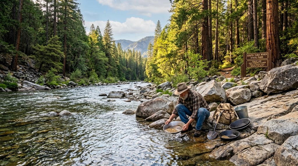
Gold was discovered on the South Yuba in June 1848, and people are still finding it. The state park covers roughly 20 miles of the river canyon from Malakoff Diggins down to the Bridgeport covered bridge, and panning is allowed park-wide using the "hands and pans" method — California State Parks classifies panning as rockhounding, and the gold pan is the only tool permitted. No shovels, no trowels, no sluices.
Metal detecting: Not allowed at South Yuba River State Park. State Parks rules restrict you to hands-and-pans only. No metal detectors permitted in the park.
If you're new to this, Bridgeport is the best on-ramp in the state: the Sierra Gold Parks Foundation runs free panning demonstrations at troughs near the Visitor Center on summer weekends, and you can walk straight from the lesson to the river. The South Yuba is mostly a fine-gold river at the surface, but the canyon's exposed bedrock means patient crevicing can turn up surprisingly nice flakes.
5. Malakoff Diggins State Historic Park (Nevada County)
Malakoff Diggins preserves the site of the largest hydraulic mine of the Gold Rush era — a man-made canyon of carved, candy-striped cliffs that's worth the trip on its own. The park offers gold panning along Humbug Creek near the old China Garden area, under the same hands-and-pans State Parks rules as the Yuba.
Metal detecting: Not allowed at Malakoff Diggins State Historic Park. State Parks restrictions apply — hands and pans only. No metal detectors permitted.
Humbug Creek drains the diggins themselves, which means it's been recharged for 150 years by gravels the hydraulic monitors never fully processed. The gold is fine, but it's consistent — and panning in the shadow of the mine that triggered America's first major environmental court ruling is a history lesson you can hold in your hand. Pair it with the ghost town of North Bloomfield inside the park.
6. Auburn State Recreation Area (Placer & El Dorado Counties)
Auburn SRA covers about 40 miles of the North and Middle Forks of the American River — some of the most storied placer ground on Earth. The park explicitly allows gold panning under the hands-and-pans rule: panning is treated as rockhounding, the pan is the only tool allowed, and collecting is limited to the natural water-washed gravels of the stream.
Metal detecting: Not allowed at Auburn SRA. Like other State Parks, the hands-and-pans rule applies. No metal detectors permitted in the recreation area.
Access is easy from Auburn via Highway 49 or Foresthill Road, with dozens of trails dropping to the river. The confluence area is popular and picked over; the farther you hike from a parking lot, the better the gravel gets. Both forks carry fine gold and flakes year-round, and the Middle Fork in particular has a reputation for rewarding people who work the bedrock cracks on inside bends after a big water year.
7. Marshall Gold Discovery State Historic Park (El Dorado County)
This is the spot — the place where James Marshall pulled gold out of the tailrace at Sutter's Mill in January 1848 and changed California forever. Today the park sits on the South Fork American River in Coloma, and panning is allowed on the east side of the river across the Mount Murphy Bridge, hands and pans only, during park hours. Bring your own pan or pick one up at the park's Mercantile.
Metal detecting: Not allowed at Marshall Gold Discovery State Historic Park. State Parks rules restrict you to hands and pans only. No metal detectors permitted.
Will you get rich at the most famous gold site in America? No — this stretch sees a lot of pans. But there's still color in the river, the setting is unbeatable for introducing kids or skeptical spouses to the hobby, and the park's exhibits will sharpen your understanding of where gold actually settles. Treat it as a pilgrimage with a side of fine gold.
Etiquette that keeps these places open
Every spot on this list stays open because prospectors, on the whole, behave. A few norms worth internalizing:
- Respect claims absolutely. If ground is posted or you find a claim marker, move on. There are over 300,000 mining claims on record in California — assume good ground is claimed until you've verified otherwise.
- Fill your holes and stay below the waterline. Digging into banks undermines vegetation and is prohibited nearly everywhere. Work the active gravel bars.
- Know your equipment limits before you go. Hands-and-pans means exactly that in State Parks. Federal designated areas each publish their own rules — read them, because they differ spot to spot.
- Leave it cleaner than you found it. Old mining trash isn't yours to add to.
Before you go: check the land status
The single most common mistake new prospectors make is panning on land they assumed was open. The spots above are safe starting points, but the moment you venture beyond designated areas — chasing that promising bend on the Trinity, say — you need to know three things: who manages the land, whether it's withdrawn from mineral entry, and whether an active claim covers it.
That's exactly the problem we built Gold Prospector to solve. The app overlays public land boundaries, historical mineral deposit data from USGS records, streams, and LiDAR terrain on one map, so you can scout legal, promising ground from your couch before you burn a tank of gas. Check the ground status before your next trip.
Good luck out there — the gold's still moving every winter. Somebody's going to find it.
Sources & Citations
- Legal Information Institute, Cornell Law School — 36 CFR § 7.91, Whiskeytown Unit gold panning regulations
- National Park Service — Gold Panning at Whiskeytown National Recreation Area
- Recreation.gov — Whiskeytown Gold Panning Pass
- Visit Trinity — Gold Panning in Trinity County
- U.S. Forest Service — Shasta-Trinity National Forest
- U.S. Forest Service — Tahoe National Forest FAQs (prospecting and the General Mining Law)
- Bureau of Land Management — Forks of Butte Creek Casual Use (Recreational) Mining Guidelines
- California State Parks — South Yuba River SP Gold Panning Rules
- Sierra Gold Parks Foundation — Gold Panning Demonstrations
- California State Parks — Malakoff Diggins State Historic Park
- California State Parks — Auburn State Recreation Area
- Marshall Gold Discovery State Historic Park — Gold Panning at Marshall Gold Discovery SHP