
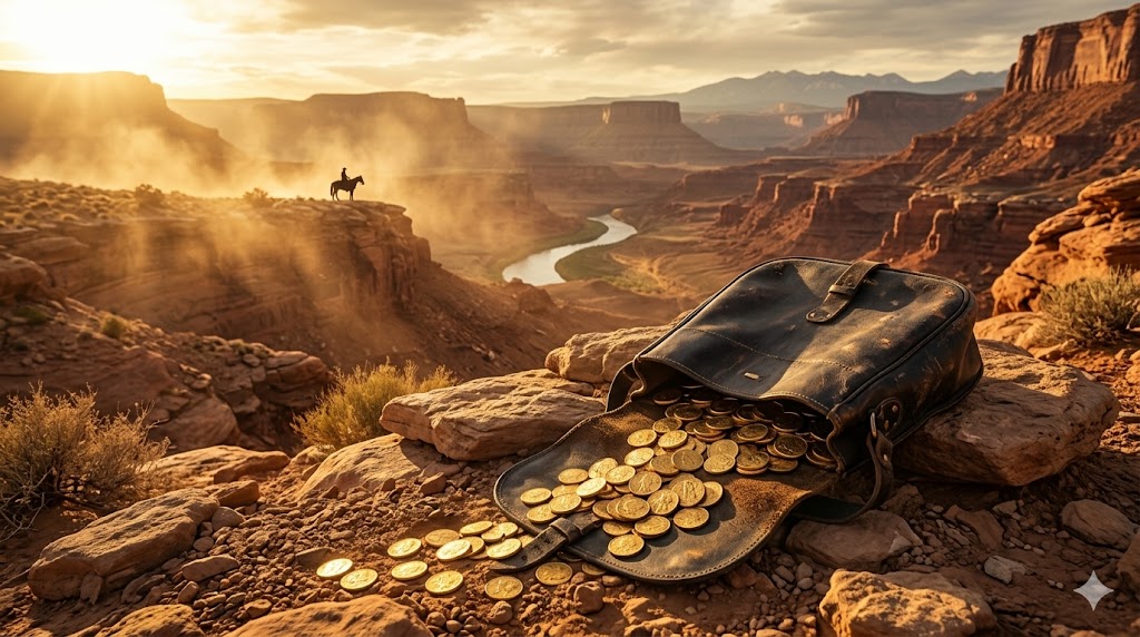
The thing about buried gold is that it stays buried. This is an obvious statement and also a profound one, because gold does not rot, does not oxidize into red dust like iron, does not slowly dissolve into the mineral broth of groundwater the way a copper coin will over centuries. Gold is chemically inert in ways that make geologists pause with something resembling reverence. A bar of gold bullion placed in Missouri clay in 1876 would, if you dug it up tomorrow, look exactly the same. It would weigh exactly the same. It would be, in every measurable way, the identical object—only the world around it would have changed beyond recognition. The farmstead would be a subdivision. The landmark oak would be a stump, or not even that. The creek that served as a waypoint would have shifted its bed a dozen times. The gold, though, would be gold.
This is why the stories persist. Not merely because people are greedy, or romantic, or credulous—though they are often all three—but because the fundamental chemistry of the element permits the fantasy to remain plausible. There is no expiration date on buried gold. And so the stories of outlaw caches, of loot hastily interred by men on the run, continue to draw searchers into the backcountry with metal detectors and shovels and a particular brightness in their eyes that you can recognize from fifty feet away.
The Chemistry of Persistence
Before we go looking for outlaws, it is worth understanding why gold endures underground in the first place. The U.S. Geological Survey classifies gold as a noble metal, a designation it shares with platinum, palladium, and a handful of others. The term is not sentimental. It is electrochemical. Gold resists oxidation because its electron configuration makes it extraordinarily reluctant to share electrons with oxygen, sulfur, or the other greedy elements that corrode lesser metals. Its standard electrode potential is +1.5 volts, which means that under normal environmental conditions—soil, water, air—it simply will not react. Bury a gold coin in acidic forest soil and return a thousand years later. The coin will be there, its edges sharp, its inscriptions legible.
This is not true of silver, which tarnishes. It is not true of copper, which develops a green patina and eventually crumbles. It is spectacularly not true of iron, which rusts so eagerly that an iron strongbox buried in damp earth might be a shapeless mass of oxide within a generation. The outlaws of the American West, many of whom were uneducated men, understood this intuitively. They may not have known the word "noble" in its chemical sense, but they knew that gold was the thing you buried when you wanted it to stay valuable. Silver was acceptable. Cash was a desperation move. Gold was forever.
Jesse James and the Caches of Clay County
No American outlaw has generated more treasure legends than Jesse Woodson James, and this is not accidental. Jesse James robbed for sixteen years—from 1866 to 1882—and the cumulative haul of the James-Younger Gang, across banks, trains, and stagecoaches, has been estimated by historians at somewhere between $200,000 and $500,000 in contemporary currency. Adjusted for inflation, the upper bound approaches fifteen million dollars. Yet when Jesse was shot by Bob Ford in his rented house in St. Joseph, Missouri, on April 3, 1882, his estate was essentially penniless. His wife, Zerelda, was left in poverty. The money had gone somewhere.
The most persistent theory is that it went into the ground—not in one place, but in many places, scattered across the landscape of western Missouri and beyond. The National Park Service notes that the James farm in Kearney, Missouri, has been a site of intense historical and archaeological interest for more than a century. The farm, now a museum, sits on rolling clay-loam terrain typical of Clay County, where the Missouri River has deposited deep alluvial soils over millennia. It is good soil for hiding things. A hole dug three feet down in Clay County bottomland will hold its shape. The clay seals around whatever you place there like a geological fist.
Jesse James grew up on that farm, and he knew its terrain the way a farmer knows terrain—not abstractly, but in the body. He knew which hollows flooded in spring and which stayed dry. He knew the locations of particular trees, particular rock outcroppings, the angles between landmarks. This kind of knowledge is essential to the creation of a cache, because a cache is useless if you cannot find it again, and in the 1870s there was no GPS. There were only landmarks, and memory, and sometimes a coded map scratched onto paper or leather.
The coded maps are where the story gets tangled. Over the decades, hundreds of alleged Jesse James treasure maps have surfaced—in attics, in estate sales, in the back pages of pulp magazines. The vast majority are transparent forgeries. But a handful have provenance that historians take semi-seriously, and several have inspired organized searches. In the 1990s, a group led by a retired police officer named Del Schrader claimed to have decoded a series of waybill symbols that Jesse James allegedly used to mark cache locations. Schrader's work, whatever its merits, attracted enough attention to be covered by The New York Times and other national outlets. No significant gold was recovered.
The difficulty, as any metal detectorist will tell you, is that the landscape has changed. Trees that served as markers have been felled. Creeks have shifted course. Buildings have been erected, torn down, and erected again. A cache described in relation to "the large elm at the bend of the south fork" becomes meaningless when the elm is gone and the south fork has been dammed. The gold, if it exists, has not moved. But the coordinate system has been destroyed.
The Wild Bunch and the High Country
If Jesse James was a creature of the Missouri bottomlands, Butch Cassidy was a creature of altitude. Robert LeRoy Parker—Cassidy's given name—operated across a vast swath of the American West, from Wyoming to Nevada, from Montana to New Mexico, but his spiritual homeland was the high desert and mountain country of Utah, Wyoming, and Colorado. His gang, the Wild Bunch, included Harry Alonzo Longabaugh (the Sundance Kid), Harvey Logan (Kid Curry), and a rotating cast of lesser desperadoes, and their preferred method was the train robbery.
The Bureau of Land Management administers millions of acres of the terrain through which Cassidy and his associates once rode, and much of it looks today almost exactly as it looked in 1899. This is the paradox of the high desert: while the Missouri bottomlands have been plowed, subdivided, and paved, the canyon country of southern Utah and the Wind River country of Wyoming remain largely undeveloped. The landmarks that Cassidy might have used to mark a cache—a distinctive sandstone formation, a particular juniper tree, a bend in a dry wash—may still exist, essentially unchanged.
The most famous hideout of the Wild Bunch was the so-called Robbers Roost, a labyrinth of canyons and mesas in Wayne County, Utah, between the Dirty Devil River and the Colorado River. The BLM manages this area today as part of its public lands in the Hanksville Field Office district. It is spectacularly remote. The nearest town of any size is Hanksville, population roughly two hundred, and the Roost itself is accessible only by dirt roads that wash out in storms. The geology is Jurassic and Cretaceous sandstone—Navajo, Entrada, Morrison formations—eroded into a maze of slots, alcoves, and overhangs that could hide an army, let alone a saddlebag of gold coins.
Did Cassidy bury gold at Robbers Roost? The historical evidence is suggestive but not conclusive. After the June 2, 1899, robbery of the Union Pacific Overland Flyer near Wilcox, Wyoming—in which the gang blew open the express car with dynamite and made off with an estimated $30,000 in unsigned banknotes—Cassidy and his companions scattered into the wilderness. The National Park Service, which interprets several sites associated with the Wild Bunch, notes that the gang's knowledge of remote terrain was their primary defensive asset. They did not merely flee; they disappeared into landscapes that pursuing posses could not navigate.
The logic of cache-making is simple in such terrain. You are on the run. You have more loot than you can safely carry or spend. You need to travel light and fast. So you find a place—a particular alcove, a rock overhang, a deep crevice in the sandstone—and you deposit the heavy stuff. You mark the spot in a way that is obvious to you and invisible to anyone else. You ride on. You plan to return later, when the heat has died down. But sometimes later never comes. Cassidy left for South America in 1901, and the conventional historical narrative holds that he was killed in Bolivia in 1908, though this has been disputed for more than a century. If he cached gold in the canyonlands of Utah, he may never have gone back for it.
The Hole-in-the-Wall: Geography as Accomplice
Another Wild Bunch stronghold—and another locus of treasure legend—is the Hole-in-the-Wall, a notch in the red sandstone cliffs along the Middle Fork of the Powder River in Johnson County, Wyoming. The "hole" is a narrow gap in a long, continuous wall of rock, passable on horseback but easily defended. Behind the wall lies a broad valley, well watered and sheltered from wind, where outlaws maintained a semi-permanent camp through the 1890s.
The BLM's Buffalo Field Office oversees much of this country, and it remains public land—open, in principle, to recreational use including metal detecting, subject to federal regulations. The Antiquities Act of 1906 and the Archaeological Resources Protection Act of 1979 prohibit the disturbance of archaeological sites on federal land, and any cache associated with a historically significant outlaw would almost certainly qualify as an archaeological resource. This is a critical legal point that every treasure hunter must understand: on federal land, you cannot simply dig up what you find. The U.S. Forest Service and the BLM both require permits for any excavation that might disturb cultural resources, and violations carry substantial penalties.
But the legends persist nonetheless. Multiple accounts from the late nineteenth century describe the Hole-in-the-Wall as a place where stolen goods were cached between robberies. The valley itself, roughly thirty miles long, contains numerous rock overhangs, small caves, and talus slopes where objects could be concealed. The geology—primarily the Tensleep Sandstone and the overlying Chugwater Formation—is porous and prone to the creation of natural shelters through differential weathering. A leather saddlebag tucked into a sandstone alcove and covered with loose rock might remain undiscovered for a very long time, particularly in country that sees few visitors.
Black Bart: The Poet Who Robbed Stagecoaches
Charles Earl Bowles, who operated under the alias Black Bart, was an anomaly among Western outlaws. He was polite. He was literate. He never fired his shotgun—it was later discovered to have been unloaded during at least some of his robberies. And he robbed not trains or banks but stagecoaches, specifically the Wells Fargo coaches that carried gold bullion and strongboxes through the mountains of Northern California.
Between 1875 and 1883, Black Bart committed twenty-eight stagecoach robberies, almost all of them in the rugged terrain between the Sacramento Valley and the coast. The California State Parks system includes several areas through which Black Bart operated, and the geography is characteristic of the Northern California Coast Ranges: steep, heavily forested ridges of Franciscan Complex rocks—greywacke, chert, serpentinite—cut by deep canyons with seasonal creeks. The roads that Wells Fargo coaches traveled were narrow, winding, and flanked by dense chaparral and conifer forest, ideal terrain for a lone bandit to step out from behind a boulder and level a shotgun.
Black Bart's total haul over eight years has been estimated at somewhere between $10,000 and $18,000 in gold and currency—a modest fortune by the standards of the era, but a significant one. When he was finally captured in 1883, after a laundry mark on a handkerchief led detectives to his San Francisco boarding house, very little of the stolen money was recovered. He served four years in San Quentin, was released in 1888, and disappeared from the historical record. Where the gold went is a question that has occupied California treasure hunters for nearly a century and a half.
The prevailing theory is that Black Bart, who operated on foot—he did not ride horses, a remarkable fact given his profession—cached his takings at intervals along his robbery routes. He walked enormous distances through the mountains, and his intimate knowledge of the terrain was his greatest asset. A man on foot in the Coast Ranges can access places that a man on horseback cannot: narrow ravines, dense thickets of manzanita, rock ledges on steep slopes. If Black Bart buried gold in such places, the hiding spots would have been chosen with a walker's eye for concealment, and they might be nearly impossible to locate without very precise information.
For modern detectorists interested in Black Bart country, the USGS geologic maps of the Northern California Coast Ranges reveal the mineralized, iron-rich soils that make metal detecting in this terrain both promising and frustrating. The serpentinite and mafic rocks of the Franciscan Complex create high background mineralization, which can produce false signals on a metal detector. Working these soils requires a detector with good ground-balancing capability and a patient operator willing to dig a lot of hot rocks before finding anything meaningful.
The Dalton Gang: Oklahoma and the Price of Ambition
The Dalton brothers—Gratton, Robert, and Emmett—were lawmen turned outlaws, a trajectory that was less unusual in the late nineteenth century than one might suppose. They had served as deputy U.S. marshals in Indian Territory before turning to robbery in 1890, and their local knowledge of the Oklahoma and Kansas landscape was encyclopedic. In two years of activity, the Daltons robbed trains and banks across a wide swath of the southern Great Plains, accumulating a fortune that was never fully accounted for.
Their end came on October 5, 1892, in Coffeyville, Kansas, when they attempted to rob two banks simultaneously—an act of overreach that is nearly Shakespearean in its hubris. The citizens of Coffeyville armed themselves, and in the ensuing battle, four of the five gang members were killed, along with four townspeople. Only Emmett survived, grievously wounded. The Kansas Historical Society maintains records and artifacts related to the Coffeyville raid, and the event has been exhaustively documented.
What has not been documented is the location of the Daltons' accumulated loot from their earlier robberies. Emmett Dalton, after serving fourteen years in prison, was released in 1907 and lived until 1937. He became a screenwriter in Hollywood, of all things, and he never publicly revealed where the gang's money was hidden. There are, however, persistent legends of Dalton caches in the Osage Hills and along the Cimarron River in Oklahoma—country that is now partly federal land, partly tribal land, and partly private ranch land. The geology is Permian red beds and Pennsylvanian limestone, with numerous caves and rock shelters in the dissected plateau country west of Tulsa. It is plausible terrain for cache-making, but the legal and jurisdictional complexity of searching in this area is formidable.
Henry Plummer and the Innocents: Montana Gold
The story of Henry Plummer is one of the most bizarre episodes in the history of the American West, and it has left a treasure legend that refuses to die. Plummer was the sheriff of Bannack, Montana Territory, in 1863—and simultaneously, according to the vigilance committee that hanged him in January 1864, the leader of a gang of road agents called the Innocents who preyed on gold shipments traveling from the mining camps of Alder Gulch to the outside world.
The Bannack townsite, now a Montana state park and a National Historic Landmark, sits at the head of Grasshopper Creek in Beaverhead County, in a landscape of sagebrush-covered benches above a narrow stream valley. The geology is Archean gneiss and Proterozoic sediments of the Belt Supergroup, intruded by Cretaceous granites of the Boulder Batholith—the same complex of igneous rocks that produced the gold deposits of the Montana mining frontier. The USGS has mapped this terrain extensively as part of its Mineral Resources Program, and the geological surveys confirm that the Bannack district produced millions of dollars in placer gold during the 1860s and 1870s.
Plummer and his alleged gang are said to have intercepted a significant portion of that gold. The Innocents, if the vigilante accounts are to be believed, robbed over a hundred travelers along the roads between Bannack and Virginia City, killing many of them. The total take has been estimated at $2.5 million in 1863 dollars—an enormous sum that, at the then-prevailing price of $20.67 per troy ounce, represented roughly 120,000 ounces of gold, or about 3.7 metric tons. Even allowing for exaggeration in the vigilante accounts—and there are good reasons to suspect exaggeration, since the vigilantes needed to justify their extralegal executions—the quantity of gold that disappeared is striking.
When Plummer was hanged, he reportedly pleaded for his life and offered to reveal the location of his cached gold. The vigilantes, grimly committed to their purpose, declined the offer. And so whatever Plummer knew about buried treasure died with him on the gallows. The legend has drawn searchers to the Bannack area for over 160 years. The Montana state park at Bannack allows metal detecting in designated areas under permit, though any finds of archaeological or historical significance must be reported to park authorities.
For the modern prospector, the Bannack district presents an interesting double opportunity: the area contains both historical placer gold deposits and potential outlaw caches, and the geological conditions that concentrated the original gold—the intersection of granitic intrusions with metasedimentary host rocks, creating contact-metamorphic aureoles where gold was mobilized and redeposited—also created the wealth that attracted outlaws in the first place. Tools like the Gold Prospector app can help identify public lands and known gold-bearing geological formations in western Montana, layering historical mining data with modern land-status information to pinpoint areas that are legally accessible and geologically promising.
The Treasure of the Superstitions: An Outlaw Angle
The Superstition Mountains east of Phoenix, Arizona, are perhaps the most storied treasure-hunting ground in North America. The primary legend—the Lost Dutchman's Mine—centers on a gold deposit, not an outlaw cache, and it has been told and retold so many times that separating fact from folklore is essentially impossible. But there is an outlaw dimension to the Superstition story that is less well known and more interesting.
In the 1870s and 1880s, the Superstition Wilderness—now managed by the Tonto National Forest—was a favored refuge for men fleeing the law. The terrain is almost absurdly hostile: volcanic tuff and basalt eroded into pinnacles, slot canyons, and cliff faces, covered in saguaro cactus, cholla, and catclaw acacia. Water is scarce, summer temperatures exceed 110°F, and navigation is disorienting even with modern maps. For an outlaw who knew the country, it was a nearly impregnable fortress. For a pursuing posse, it was a deathtrap.
Several documented outlaws used the Superstitions as a base of operations, raiding mining camps and stagecoach routes in the surrounding lowlands and retreating into the mountains with their spoils. The Apache, who controlled the area before being forcibly removed, had their own complex relationship with the mountain's mineral wealth, and the intersection of Apache knowledge, Mexican mining traditions, and Anglo outlaw activity creates a tangle of overlapping treasure legends that is practically impossible to unravel.
The U.S. Forest Service has struggled for decades with the tension between the Superstition Wilderness's status as a federally designated Wilderness Area—where mechanized equipment, including metal detectors, is generally prohibited—and the relentless pressure from treasure seekers. The Wilderness Act of 1964 established strict protections for designated wilderness areas, and the Superstition Wilderness was among the original units. Metal detecting is not permitted within the wilderness boundary, though it may be allowed on adjacent Forest Service lands outside the wilderness boundary, subject to regulations.
Sam Bass: Texas Gold and a Dying Confession
Sam Bass was, by most accounts, a mediocre outlaw—impulsive, disorganized, and spectacularly bad at not getting caught. But he was involved in one of the most lucrative robberies of the nineteenth century, and the proceeds have never been fully recovered, which makes him important to our story.
On September 18, 1877, Bass and five accomplices robbed a Union Pacific train at Big Springs, Nebraska, and discovered that the express car contained $60,000 in freshly minted twenty-dollar gold pieces—three thousand coins in sixty-pound sacks—being shipped from the San Francisco Mint to Eastern banks. This was an extraordinary haul. The gang split the gold six ways, giving each man $10,000 in coins, roughly thirty pounds of gold apiece.
Bass fled to the limestone hills of central Texas, where he spent the next ten months robbing stagecoaches and banks with diminishing success. He was shot by Texas Rangers in Round Rock, Texas, on July 19, 1878, and died the following day—his twenty-seventh birthday. According to multiple accounts, his last words, or near-last words, when pressed by a Ranger to reveal the location of his cached gold, were: "It is agin my profession to blow on my pals. If a man knows anything, he ought to die with it in him."
The Texas Historical Commission has documented the Round Rock shootout site, and the story of Sam Bass's buried gold has been a fixture of Texas folklore for nearly 150 years. The most common theory places the cache somewhere in the limestone country around Denton or Cove Hollow in Denton County, where Bass maintained a hideout. The geology is Lower Cretaceous limestone of the Comanche Plateau—karstified terrain riddled with caves, sinkholes, and fissures that are natural repositories for hidden objects. Limestone caves maintain stable temperatures and humidity, and gold stored in such an environment would be perfectly preserved.
The difficulty, as always, is precision. "Somewhere in the limestone country around Denton" describes thousands of square miles. Without specific landmarks or a reliable map, finding a cache in karst terrain is essentially hopeless—like searching for a particular grain of sand on a beach. The caves are numerous, many are unexplored, and the surface expressions of the karst system (sinkholes, springs, disappearing streams) shift over time as dissolution continues to reshape the rock.
The Practical Art of Looking
Assume, for the sake of argument, that you are convinced. You believe that Jesse James buried gold in Missouri, or that Butch Cassidy cached coins in the Utah canyonlands, or that Sam Bass's twenty-dollar gold pieces are waiting in a Texas cave. What do you do?
The first thing you do—the absolutely essential, non-negotiable first thing—is determine the land status of the area you want to search. This sounds mundane, and it is mundane, and it is also the step that separates legal treasure hunting from criminal trespass and the destruction of archaeological resources. The land status of any given parcel in the American West can be bewilderingly complex: federal, state, county, municipal, tribal, or private, with easements, mineral rights, and surface rights that may be held by different entities. The BLM's General Land Office Records are the authoritative source for federal land status, and the BLM's online mapping tools allow you to determine, with reasonable precision, whether a specific location is on public land.
On BLM land, recreational metal detecting is generally permitted under the agency's regulations, with important caveats. You may not excavate, remove, damage, or otherwise alter or deface any archaeological resource, which is defined as any material remains of human life or activities that are at least one hundred years old. An outlaw cache from the 1870s or 1880s would almost certainly meet this threshold. The Archaeological Resources Protection Act (ARPA) imposes criminal penalties of up to $100,000 and imprisonment for the unauthorized excavation of archaeological resources on federal or tribal land. If you find something significant, you are legally obligated to stop digging and notify the land management agency.
On U.S. Forest Service land, similar rules apply. The Forest Service's responsible recreation guidelines allow casual-use metal detecting in most areas but prohibit disturbance of cultural resources. In designated Wilderness Areas, metal detectors are generally prohibited as mechanized equipment under the Wilderness Act.
On state land, rules vary enormously. California State Parks, for instance, generally prohibit metal detecting within state park units. Montana allows limited detecting in some state parks under permit. Texas has its own set of rules. You must research the specific regulations for each jurisdiction before you search.
On private land, you need the landowner's permission, period. Many of the most promising outlaw cache sites are on private ranch land, and accessing them without permission is trespassing. Some landowners are receptive to treasure hunters; others will escort you off at gunpoint. It is prudent to have a written agreement specifying the division of any finds before you begin.
The Technology of the Search
The metal detector is, of course, the primary tool of the modern treasure hunter, and the technology has improved dramatically in recent decades. Early detectors, which operated on the beat-frequency oscillation (BFO) principle, could barely distinguish a gold coin from a rusty nail at six inches. Modern pulse induction (PI) and multi-frequency detectors can identify specific metals at depths of two feet or more, with discrimination circuits that filter out ferrous junk and alert the user only to non-ferrous targets.
For outlaw cache hunting, depth is the critical variable. A cache buried two or three feet deep—the typical depth for a hastily dug hole—is within the range of a good mid-range detector. A cache buried deeper, or concealed in a rock crevice with significant overburden, may require a two-box or deep-seeking detector, which uses a larger coil configuration to detect large metallic masses at greater depths. These instruments sacrifice discrimination—they cannot tell you whether the target is gold or iron—but they can detect a saddlebag-sized mass of metal at depths of six feet or more.
Ground conditions matter enormously. The mineralized soils of the Arizona desert, the iron-rich serpentinite of the California Coast Ranges, and the alkali flats of the Great Basin all present challenges for metal detecting. Ground balancing—the process of calibrating the detector to ignore the background mineral signal of the soil—is essential in these environments. A detector that is not properly ground-balanced will produce a constant stream of false signals, rendering it useless.
Beyond the detector itself, modern treasure hunters have access to tools that Jesse James and Butch Cassidy could not have imagined. Satellite imagery, LiDAR topographic data, and high-resolution geological maps allow you to study terrain remotely before ever setting foot on it. Apps like Gold Prospector aggregate public land data, geological surveys, and historical mining records into a format that can be consulted in the field, helping you identify areas that are both geologically interesting and legally accessible. The ability to overlay historical information on modern maps—to see, for instance, where a nineteenth-century road crossed a particular creek, or where a now-vanished settlement once stood—can be invaluable in narrowing a search area from thousands of square miles to a manageable few acres.
The Epistemology of Treasure Legends
It is necessary, at this point, to say something about evidence. The stories I have recounted above range from the well-documented (the Sam Bass robbery at Big Springs, with its $60,000 in gold coins, is a matter of federal record) to the deeply speculative (the precise amount of gold that Henry Plummer's Innocents may have stolen is essentially unknowable). Between these poles lies a vast gray zone of partial evidence, oral tradition, family lore, and outright fabrication.
The serious treasure researcher—and they do exist, and some of them are rigorous and methodical in ways that would impress an academic historian—approaches these legends with a framework that is essentially journalistic. They ask: What is the primary source? Is it a contemporary newspaper account, a court document, a letter? Or is it a reminiscence written decades after the fact, filtered through memory and the desire to tell a good story? Is the source corroborated by independent evidence? Does the physical geography support the claim?
The National Archives contain an enormous quantity of primary-source material related to Western outlaws: court records, Pinkerton detective agency files, U.S. Marshal reports, military dispatches, and correspondence. Much of this material has been digitized and is available online. For anyone serious about researching an outlaw cache legend, the Archives are an indispensable starting point. The records of the Wells Fargo corporate archive, portions of which are held by the Wells Fargo History Museum, contain detailed records of stagecoach robberies, including the amounts stolen, the routes traveled, and the suspects identified—information that can be cross-referenced with geographical data to narrow potential cache locations.
The fundamental question, with any treasure legend, is whether the missing gold actually exists. In many cases, the answer is probably not. The outlaw may have spent the money. He may have gambled it away, or given it to associates, or sent it to relatives. The amounts reported in contemporary newspapers may have been exaggerated—robbery victims routinely inflated their losses for insurance purposes, and newspapers routinely inflated them for dramatic effect. The prosaic explanation—that the money was dissipated through ordinary expenditure—is almost always more likely than the romantic one.
But not always. And it is the "not always" that keeps people looking.
The Reno Brothers: Before Jesse James
Before Jesse James, before Sam Bass, before the Wild Bunch, there were the Reno brothers of Seymour, Indiana—Frank, John, Simeon, and William—who are generally credited with committing the first peacetime train robbery in American history, on October 6, 1866. The Renos robbed trains, county treasuries, and private businesses across southern Indiana and into Missouri, accumulating a fortune that was estimated at over $100,000 in the late 1860s.
Their story ended badly: three of the four brothers were lynched by a vigilance committee that broke into the New Albany, Indiana, jail on December 12, 1868. The fourth had already been sent to prison. And the money—the tens of thousands of dollars in gold, silver, and currency—was never recovered.
Southern Indiana, where the Renos operated, is geologically distinct from the Western landscapes we have been discussing. The terrain is underlain by Mississippian and Devonian limestones and shales—part of the broader Midwestern karst landscape that extends from Indiana through Kentucky into Tennessee. Like the Texas Hill Country where Sam Bass allegedly cached his gold, this is cave country: sinkholes, underground rivers, solution-enlarged fissures in the bedrock. The USGS has mapped extensive karst features in southern Indiana, and the region is known for its cave systems, some of which are enormous and many of which remain incompletely explored.
The Reno brothers knew this landscape intimately—they grew up in it, farmed it, hunted it. The caves and rock shelters of the Indiana karst would have been obvious hiding places for stolen valuables, and several local traditions point to specific caves in Jackson and Washington Counties as possible cache sites. Whether any of these traditions have a factual basis is impossible to determine at this remove, but the geological suitability of the terrain for cache-making is beyond question.
What Endures
I have been describing these stories as if they were primarily about gold, but of course they are not primarily about gold. They are about landscape, and memory, and the human compulsion to believe that the earth holds secrets that reward the persistent searcher. This is the same compulsion that drives the placer miner to work a gravel bar in a freezing creek, and the hard-rock prospector to follow a quartz vein into a mountain, and the detectorist to sweep a plowed field for the hundredth time. It is the conviction that the ground is not empty—that beneath the surface, something waits.
The outlaws are long dead. Their bones are in marked graves or unmarked ones, in churchyards and potter's fields and, in Butch Cassidy's case, possibly in a Bolivian cemetery or possibly somewhere else entirely. The posses that chased them are dead too, and the horses they rode, and the railroads they robbed. The specific violences of their lives—the gunfights, the dynamited express cars, the midnight escapes—have faded into the same past that contains everything else that has ever happened.
But the gold, if it is there, has not faded. Gold does not fade. It sits in its clay or its limestone or its sandstone alcove, exactly as heavy and exactly as yellow as the day it was placed there, waiting with the infinite patience of an element that has existed since a neutron star collision scattered it across the primordial solar nebula four and a half billion years ago. The outlaws were temporary. The gold is not.
This is what makes outlaw cache hunting a peculiar subset of the broader enterprise of gold prospecting. The geological prospector searches for gold where the earth put it—in placer deposits, in lode veins, in the weathered surfaces of auriferous rock. The cache hunter searches for gold where a human being put it, which means the search is as much historical and psychological as it is geological. You need to understand not just the terrain but the mind of the person who used the terrain. How did Jesse James think? What did a man on the run, with saddlebags full of gold coins, see when he looked at a Missouri hillside? Where, in his calculus of risk and retrieval, would he have chosen to dig?
These are unanswerable questions, in the strict sense. But they are not unproductive ones. They force you to look at the landscape with a specificity and an intentionality that ordinary sight does not require. They make you notice the hollow behind the rock ledge, the dry spot at the base of the bluff, the patch of ground where the soil color changes. They make you, in short, a better observer of the land—which is, in the end, the fundamental skill of any prospector, whether you are looking for gold that the earth deposited or gold that a desperate man buried on a dark night in 1877.
The search continues. It will continue as long as gold is gold, and as long as the stories survive, and as long as there are people willing to walk into the backcountry with a metal detector and a theory and that unmistakable brightness in their eyes. Most of them will find nothing. A few will find artifacts—buttons, buckles, horseshoes, the detritus of a vanished world. And perhaps, someday, one of them will find the thing itself: a saddlebag, or a strongbox, or a leather pouch full of double eagles, still gleaming after a century and a half in the dark.
The gold will look exactly the same.
Sources & Citations
- USGS – Gold Statistics and Information
- National Park Service – Jesse James
- Bureau of Land Management – Robbers Roost
- Bureau of Land Management – Homepage
- National Park Service – Homepage
- BLM Buffalo Field Office, Wyoming
- U.S. Forest Service – Homepage
- California State Parks
- USGS National Geologic Mapping Program
- Kansas Historical Society
- NPS – Bannack, Montana
- USGS Mineral Resources Program
- U.S. Forest Service – Tonto National Forest
- Tonto National Forest – Superstition Wilderness
- Texas Historical Commission
- BLM General Land Office Records
- NPS – Archaeological Resources Protection Act (ARPA)
- U.S. Forest Service – Responsible Recreation
- National Archives
- Wells Fargo History
- USGS Upper Midwest Water Science Center
- Gold Prospector iOS App