
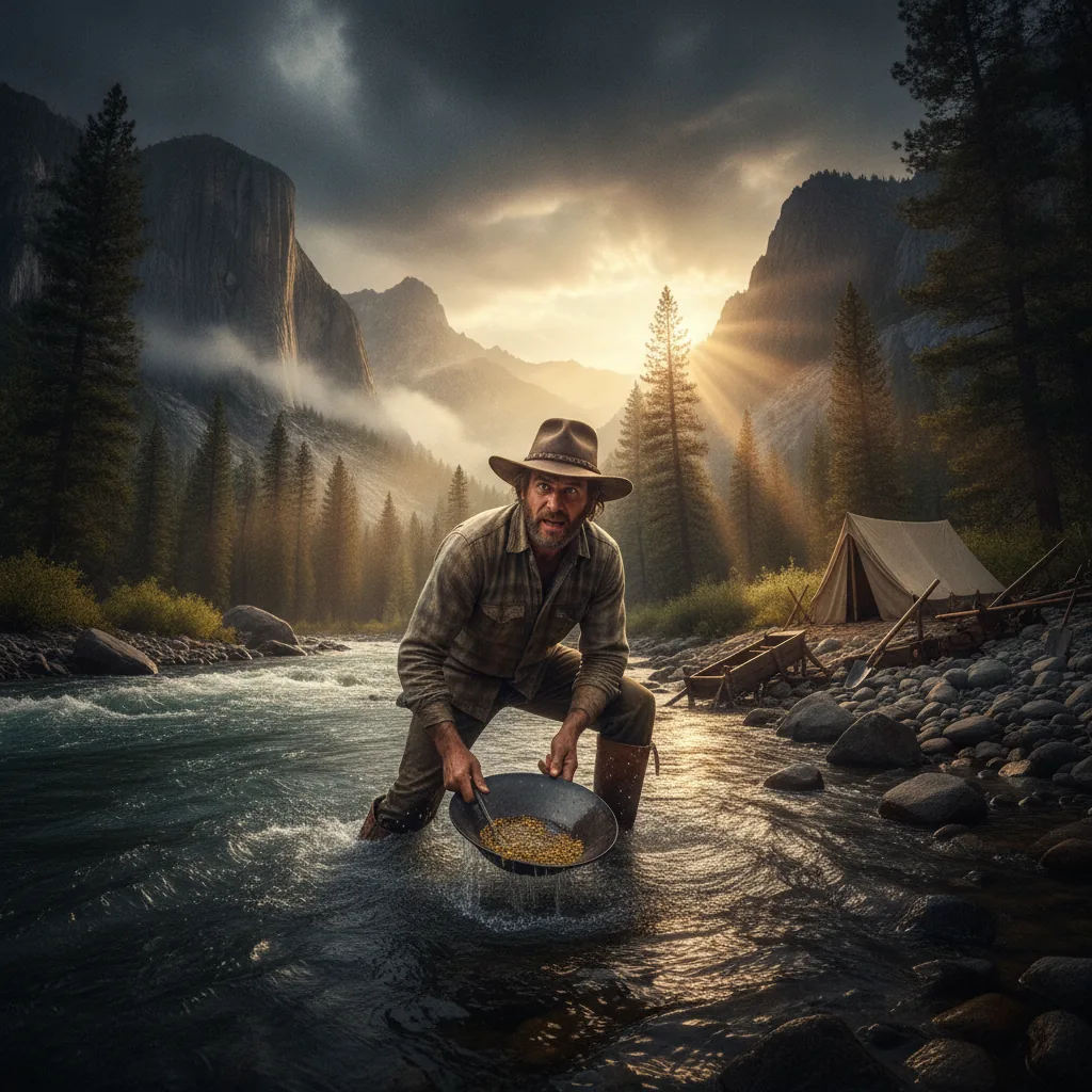
We were somewhere around the Stanislaus River, on the edge of the Sierra Nevada foothills, when the madness began to take hold. I remember saying something like "I feel a strange kinship with these rocks…" And suddenly there was a terrible roar all around us and the sky was full of what looked like enormous vultures, swooping and screeching and diving around the truck, which was going about sixty miles an hour with the top down to Sonora. And a voice was screaming: "Holy Jesus! What are these goddamn animals?"
Then it was quiet again. My attorney had taken his shirt off and was pouring Gold Pan classifier water over his chest, to facilitate the tanning process. "What the hell are you yelling about?" he muttered, staring up at the sun with his eyes closed and covered with wrap-around Spanish sunglasses. "Never mind," I said. "It's your turn to drive." I hit the brakes and aimed the Great Red Shark toward the shoulder of the highway. No point mentioning those vultures, I thought. The poor bastard will see them soon enough.
But this was no hallucination. This was gold country — the savage, sun-bleached, historically violent heartland of American greed and ambition, where men in 1849 murdered each other over creek beds and where today, in the year of our Lord 2026, you can still wade into a river with a gold pan and pull yellow metal out of the earth like some kind of feral geological dentist extracting teeth from the jawbone of the continent. The question — the only question that matters to anyone crazy enough to chase this particular dragon — is where.
Where do you go? Where is the gold? Where can you legally get your hands on it without ending up in a county lockup or, worse, on the wrong end of a federal land management dispute that will grind your soul into powder finer than any flour gold you'll ever find?
These are the questions I set out to answer. And the answers, as it turns out, are weirder and more beautiful and more legally treacherous than anything I could have fabricated in a motel room on Route 49 with a bottle of Wild Turkey and a stack of USGS topographic maps.
I. The Geological Gospel: Why Gold Is Where It Is
Before we talk about locations, we need to talk about why those locations exist in the first place. Because gold doesn't just materialize in creek beds like some kind of geological miracle. It has a history — a deep, ancient, violently hot history that stretches back billions of years, and if you don't understand at least the broad strokes of that history, you're just a tourist with a pan.
Gold forms deep in the earth's crust, the product of hydrothermal processes that push superheated fluids through fractures in rock. These fluids — carrying dissolved gold, among other metals — cool and deposit their precious cargo in veins of quartz. The United States Geological Survey (USGS) has documented this process extensively, noting that most primary gold deposits in the western United States are associated with metamorphic rocks and intrusive igneous bodies — the geological scars left behind when ancient ocean plates collided with the North American continent.
The Sierra Nevada batholith, that massive body of granitic rock that forms the backbone of California's great mountain range, is one of the most significant of these geological features. When the Farallon Plate subducted beneath the North American Plate roughly 150 to 80 million years ago, the resulting volcanic and metamorphic activity created the conditions for gold-bearing quartz veins to form throughout what we now call the Mother Lode — a 120-mile belt of gold-bearing rock stretching from Mariposa to Georgetown along the western slope of the Sierra Nevada.
But here's the thing that separates the amateur from the obsessive: primary gold deposits — those quartz veins buried in hard rock — are only half the story. The other half, and the half that matters most to the recreational prospector, is placer gold. Placer deposits form when erosion breaks down those primary veins over millions of years, and gravity and water carry the freed gold particles downhill, concentrating them in stream beds, river bends, and ancient channels. The USGS's landmark publication, Bulletin 610: "Gold Deposits of the United States", remains one of the most comprehensive catalogs of both lode and placer deposits ever compiled, and any serious prospector should treat it like scripture.
Gold is heavy — roughly 19.3 times the density of water. This means it settles. It sinks. It finds the lowest point in every geological situation it encounters. Inside bends of rivers, behind large boulders, in bedrock cracks, at the base of waterfalls — these are the places where placer gold accumulates, and understanding this simple physical principle is worth more than any treasure map ever drawn.
II. California: The Mother of All Gold Rushes and the Grandmother of All Regulations
Let's start with California, because you have to. It's the alpha and omega. The big bang. The place where, on January 24, 1848, a carpenter named James Marshall spotted something glinting in the tailrace of a sawmill on the South Fork of the American River and detonated a human migration event that would reshape the entire Western Hemisphere.
The Marshall Gold Discovery State Historic Park in Coloma marks the spot, and it's worth visiting if only to stand in the river and feel the full weight of what happened here. Within two years of Marshall's discovery, over 300,000 people had descended on California. San Francisco went from a sleepy port to a boomtown overnight. The indigenous Nisenan people, who had lived along these rivers for thousands of years, were nearly annihilated. The environmental devastation was staggering. And the gold — oh, the gold was real. The USGS estimates that California produced over 100 million troy ounces of gold between 1848 and the present day, making it the most productive gold-producing state in American history.
Today, the Mother Lode region remains the most popular destination for recreational gold prospecting in the country, and for good reason: there's still gold there. Rivers like the American, Yuba, Feather, Stanislaus, Mokelumne, and Merced continue to produce fine gold and occasional nuggets for those willing to work for them. The Tahoe National Forest and the Eldorado National Forest encompass vast tracts of public land along these waterways where recreational gold panning is generally permitted.
But — and this is the kind of "but" that can ruin your weekend or your year — California has some of the most complex and restrictive regulations governing gold prospecting of any state in the nation. The use of suction dredges, once the bread and butter of serious placer miners, has been effectively banned since 2009 under a moratorium that the California legislature made permanent with Senate Bill 637. The state's Department of Fish and Wildlife requires permits for any mechanized mining activity in or near waterways, and the permitting process is, to put it charitably, not designed for speed.
This means that in California, you are largely limited to non-motorized methods: gold panning, sluice boxes (in some areas, with restrictions), and hand tools. Which is fine — people have been finding gold with pans since before the Romans — but it requires adjusting your expectations. You're not going to retire on what you find with a pan and a classifier in the North Fork of the American River. What you might do, if you're patient and lucky and slightly unhinged, is pull a few grams of beautiful flour gold out of a bedrock crack and feel something that no amount of money can buy: the raw, electric thrill of finding treasure in the dirt.
Key California locations worth investigating include:
The American River (North, Middle, and South Forks): The birthplace of the Gold Rush. The South Fork near Coloma is heavily visited but still produces gold. The North Fork, particularly in the Auburn State Recreation Area managed by California State Parks, offers excellent panning opportunities in a stunning canyon setting.
The Yuba River: Perhaps the most consistently productive recreational prospecting river in California. The South Yuba, flowing through the South Yuba River State Park and adjacent BLM lands, has yielded gold for nearly 180 years and shows no sign of stopping.
The Kern River: In Southern California's Sierra Nevada, the Kern River and its tributaries in the Sequoia National Forest offer prospecting opportunities that are often less crowded than the Mother Lode.
The Klamath Mountains: Northern California's Klamath and Trinity River systems, flowing through the Klamath National Forest, are historically rich gold-producing areas that remain productive for recreational panners.
III. The Bureau of Land Management: Your Best Friend and Your Worst Nightmare
The Bureau of Land Management (BLM) manages approximately 245 million acres of public land in the United States, most of it in the Western states. This is an almost incomprehensible amount of land — more than the entire state of Texas, with room left over for a small European country. And on much of this land, recreational gold prospecting is permitted, subject to regulations that vary by state and by specific land management area.
The BLM operates under the General Mining Law of 1872, one of the oldest and most controversial pieces of environmental legislation still on the books. This law — signed by President Ulysses S. Grant when the frontier was still very much open — grants U.S. citizens the right to explore for and develop mineral resources on federal public domain lands. It's the legal foundation upon which all recreational prospecting on BLM land rests, and it's been the subject of fierce political debate for decades.
Under this law, you can file a mining claim on BLM land, giving you the right to extract minerals from a specific parcel. But for the casual prospector — the weekend warrior, the vacation panner, the retired couple with a metal detector and a dream — mining claims are usually overkill. What you need to know is this: on most BLM land that is open to mineral entry, casual use prospecting is permitted without a permit or a claim.
The BLM defines "casual use" as activities that do not cause significant surface disturbance. This includes gold panning, using a hand-operated sluice box, and metal detecting. It does not include the use of motorized equipment, suction dredges, or any activity that involves digging holes larger than what could reasonably be backfilled by hand. The line between "casual use" and "notice-level" or "plan-level" operations is not always clear, and the consequences of crossing it can be severe.
But here's the beautiful thing: there is an enormous amount of BLM land in the gold-bearing regions of the West where you can legally show up with a gold pan and start working. The trick is knowing where these lands are, whether they're open to mineral entry, and whether anyone else has already filed a claim on the spot you're eyeing.
The BLM's Mining Claims and Sites Database (LR2000) is the definitive resource for checking existing mining claims. And tools like the Gold Prospector app can help you navigate the Byzantine landscape of public land boundaries, active claims, and known gold-bearing areas from the convenience of your phone — which, in the field, where cell service is spotty and topo maps are heavy, is not a trivial advantage.
IV. Alaska: The Last Frontier, Literally
If California is where the gold rush started, Alaska is where it went to get serious. The Klondike Gold Rush of 1896-1899 drew an estimated 100,000 stampeders north, most of whom never found a damn thing except frostbite, scurvy, and a hard lesson about the indifference of nature. But those who did find gold — the lucky, the persistent, the borderline insane — pulled out fortunes that would be worth billions in today's dollars.
Alaska remains, in many ways, the prospector's paradise. The state contains vast tracts of gold-bearing land, much of it accessible only by bush plane or boat, and the regulations are generally more permissive than those in the Lower 48. The BLM Alaska State Office oversees millions of acres of public land where recreational prospecting is permitted under casual use provisions.
The Alaska Department of Natural Resources, Division of Mining, Land and Water manages mineral rights on state-owned lands and provides detailed information about where prospecting is allowed. State lands are abundant in Alaska, and many of them are open to mineral entry.
Key Alaska prospecting areas include:
The Fortymile River District: One of the oldest mining districts in the state, located in eastern Interior Alaska. Gold was discovered here in 1886, and the area continues to produce. The BLM manages the Fortymile Wild and Scenic River corridor, where recreational panning is permitted. The gravels here have produced both fine gold and spectacular nuggets.
Nome and the Seward Peninsula: Famous for its beach gold deposits — yes, you can literally pan gold from the beach — Nome is one of the most unique prospecting destinations in the world. The USGS Alaska Science Center has documented the extensive placer deposits in this region, which were formed by ancient marine and glacial processes.
The Fairbanks District: The hills surrounding Fairbanks, particularly the Cleary Summit, Ester Dome, and Chatanika areas, are riddled with gold. The Alaska Division of Geological and Geophysical Surveys has published extensive research on the gold deposits of the Fairbanks mining district.
Crow Creek Mine: Located along the Seward Highway south of Anchorage, this historic mine offers public gold panning on private claims — one of the more accessible Alaska prospecting experiences for tourists, though it operates on a fee basis.
Alaska prospecting carries unique challenges that California prospectors never face: grizzly bears, extreme cold, vast distances, limited road access, and a level of isolation that can be genuinely dangerous. But the rewards — both in terms of gold and in terms of the raw, untamed experience of working in true wilderness — are unmatched anywhere in the country.
V. The American Southwest: Desert Gold and the Ghosts of Lost Mines
The American Southwest — Arizona, Nevada, New Mexico, Utah — is where gold prospecting shades into something more mythological. This is the land of lost mines and buried treasure, of the Lost Dutchman and the Seven Cities of Cíbola, where the line between geology and legend blurs in the shimmering heat haze.
But beneath the mythology, there is real gold. Lots of it.
Arizona has produced over 16 million troy ounces of gold since mining began in the mid-1800s, according to Arizona Geological Survey records. The state's gold deposits are associated with a variety of geological settings, from volcanic-hosted epithermal deposits in the southwestern deserts to placer accumulations in the mountain streams of the Bradshaw and Superstition ranges.
Key Arizona prospecting areas include the Hassayampa River near Wickenburg, the Lynx Creek area in the Prescott National Forest (which has a designated recreational gold panning area), the Rich Hill area near Congress, and the drainages of the Superstition Mountains east of Phoenix.
The BLM Arizona State Office manages millions of acres of desert land, much of it open to recreational prospecting. The Arizona desert presents its own set of challenges — extreme heat, venomous wildlife, limited water — but the geology is favorable, and the competition for spots is often less intense than in California.
Nevada is one of the most significant gold-producing regions on Earth. The state currently produces more gold than any other in the United States — by a wide margin. The USGS Mineral Commodity Summary for Gold consistently shows Nevada accounting for approximately 72 percent of total U.S. gold production. However, virtually all of this comes from large-scale commercial mining operations — the Carlin Trend, the Cortez Hills, the Turquoise Ridge — run by multinational corporations with budgets that dwarf the GDP of small nations.
For the recreational prospector, Nevada offers opportunities primarily in the placer deposits of its numerous desert washes and mountain streams. The BLM Nevada State Office oversees vast public lands, and areas like the Rye Patch area, the Spring Valley mining district, and the drainages around Virginia City offer recreational panning possibilities.
New Mexico has a rich but often overlooked mining history. The New Mexico Bureau of Geology and Mineral Resources documents significant gold production from districts like the Ortiz Mountains, the Hillsboro district, and the Mogollon district in the Gila region. BLM and National Forest lands in these areas may offer recreational prospecting opportunities, though as always, checking land status and existing claims is essential before you start digging.
VI. The Pacific Northwest: Rain, Green, and Gold
Oregon and Washington are not the first states most people think of when they think of gold prospecting, but they should be. Both states have significant gold-bearing regions, and the competition for spots is generally much lighter than in California.
Oregon produced substantial quantities of gold during the 19th century, particularly from the placer and lode deposits of southwestern Oregon. The Oregon Department of Geology and Mineral Industries (DOGAMI) has documented gold production from numerous districts, including the famous Rogue River and its tributaries, the Applegate River, Galice Creek, and the Bohemia mining district in the Cascades.
The Rogue River-Siskiyou National Forest encompasses vast areas of gold-bearing terrain in southwestern Oregon. Recreational panning is generally permitted on National Forest lands, subject to forest-specific regulations. The BLM Oregon/Washington State Office manages additional public lands in gold-bearing areas.
Oregon, like California, has restrictions on motorized mining equipment in waterways, but non-motorized prospecting methods are generally allowed on public lands open to mineral entry.
Washington State offers prospecting opportunities primarily in the Cascades and northeastern regions. The Blewett area, the Swauk Creek drainage, the Sultan River, and the streams around Republic in Ferry County have all historically produced placer gold. The Washington Department of Natural Resources, Division of Geology and Earth Resources provides geological information on these deposits.
VII. The Rocky Mountain States: Colorado, Montana, Idaho, and the Hard-Rock Legacy
The Rocky Mountain states represent some of the most geologically complex and historically significant gold-producing regions in North America. The prospecting here tends to be more rugged, more remote, and more altitude-dependent than in the coastal states, but the gold is real and the scenery will break your heart.
Colorado was the site of the Pike's Peak Gold Rush of 1858-1861, which drew tens of thousands of "Fifty-Niners" to the Front Range and eventually into the high mountain basins beyond. The Colorado Geological Survey documents major gold production from districts including Cripple Creek, Central City-Black Hawk, Breckenridge, Leadville, and the San Juan Mountains. Placer gold is found in streams draining these districts, and recreational panning is permitted on many National Forest and BLM lands.
The Arapaho and Roosevelt National Forests and the Pike and San Isabel National Forests encompass significant gold-bearing terrain. BLM lands along Clear Creek, the Arkansas River, and in South Park offer additional opportunities. Colorado's altitude and weather create a short prospecting season at higher elevations — many streams are inaccessible or dangerously cold until June or July.
Montana had its own gold rush in the 1860s, with major strikes at Bannack, Virginia City, Last Chance Gulch (now Helena), and Confederate Gulch. The Montana Bureau of Mines and Geology documents extensive placer and lode deposits across the western half of the state. The Helena-Lewis and Clark National Forest and the Beaverhead-Deerlodge National Forest contain excellent prospecting grounds.
Libby Creek, near Libby in northwestern Montana, is particularly noteworthy — the Kootenai National Forest operates a designated recreational gold panning area along this creek, making it one of the most accessible and beginner-friendly prospecting destinations in the Northern Rockies.
Idaho is another historically rich gold state, with major placer deposits in the Boise Basin, the Clearwater drainage, and the Salmon River country. The Idaho Geological Survey documents gold production from numerous districts. The Boise National Forest and the vast Salmon-Challis National Forest offer remote, productive prospecting in spectacular wilderness settings.
VIII. The Southeast: Georgia, the Carolinas, and the Gold Rush You Never Heard Of
Here's a fact that will rearrange your understanding of American history: the first major gold rush in the United States did not happen in California. It happened in Georgia. In 1828 — twenty years before Marshall's discovery at Sutter's Mill — gold was discovered near Dahlonega, Georgia, setting off a stampede that drew thousands of miners to the southern Appalachians and directly contributed to the forced removal of the Cherokee Nation from their ancestral lands.
The USGS has documented significant gold deposits throughout the Appalachian gold belt, a geological formation stretching from Alabama through Georgia, the Carolinas, Virginia, and into Maryland. The gold here is associated with metamorphic rocks of the Piedmont region — ancient seafloor sediments that were folded, heated, and mineralized during the Taconic and Acadian orogenies hundreds of millions of years ago.
Georgia: The area around Dahlonega remains productive for recreational prospecting. The Chattahoochee-Oconee National Forest encompasses gold-bearing terrain, and several private mining operations in the area offer public gold panning. The Chestatee and Etowah Rivers and their tributaries are historically productive.
North Carolina: The Reed Gold Mine in Midland, North Carolina, was the site of the first authenticated gold find in the United States (1799) and is now a State Historic Site. North Carolina's gold belt stretches through the central Piedmont, and streams in counties like Stanly, Cabarrus, Mecklenburg, and Union have produced gold for over 200 years.
South Carolina and Virginia: Both states have documented gold deposits in their Piedmont regions, though prospecting opportunities on public land are more limited than in the western states. The George Washington and Jefferson National Forests in Virginia encompass some gold-bearing terrain.
IX. Where You Absolutely, Positively Cannot Prospect
Now we come to the part of the article that no one wants to read but everyone needs to. Because the fastest way to ruin a perfectly good prospecting trip — and potentially your life, or at least your bank account — is to prospect in a place where prospecting is illegal.
National Parks: Absolutely off-limits. The National Park Service prohibits mining and mineral collection in virtually all units of the National Park System. This includes National Parks, National Monuments, National Seashores, National Lakeshores, and most other NPS-administered areas. The penalties are real, and the Park Service rangers are not amused by people who claim ignorance.
Wilderness Areas: Designated wilderness areas, whether managed by the U.S. Forest Service, the BLM, or the Fish and Wildlife Service, generally prohibit or severely restrict mining activities. The Wilderness Act of 1964 sets the framework, though some pre-existing mining claims in wilderness areas may still be valid.
National Monuments: Most national monuments prohibit mineral entry and prospecting. The establishment of a national monument typically withdraws the land from mineral entry under the Antiquities Act of 1906.
Private Land: This should go without saying, but it apparently doesn't: you cannot prospect on private land without the explicit permission of the landowner. Period. Full stop. In many western states, the surface estate and mineral estate can be owned by different parties, adding another layer of complexity.
Active Mining Claims: If someone else has a valid mining claim on a piece of public land, you cannot prospect on that claim without their permission. The BLM's LR2000 database is your primary tool for checking claim status, and the Gold Prospector app provides a mobile-friendly way to cross-reference your location against known claims and land status — an invaluable tool when you're standing in a creek bed with no cell service trying to figure out if you're about to trespass on someone's claim.
Native American Reservations: Tribal lands are sovereign territory. Prospecting on reservation land without explicit authorization from the tribal government is illegal and deeply disrespectful. Don't do it.
X. The Art of Reading a Landscape: Choosing Your Spot Within the Spot
So you've identified a legal, gold-bearing area on public land. You've checked the mining claims. You've read the forest plan or the BLM resource management plan. You've driven hours to get there. Now what?
Now you need to read the landscape. And this is where prospecting transforms from bureaucratic navigation into something more primal — a dialogue between you and the earth, mediated by gravity and water and millions of years of geological process.
The USGS's classic publication "Placer Examination: Principles and Practice" lays out the fundamental principles of placer gold deposition that every prospector should internalize:
Inside bends of rivers and streams: Water slows on the inside of a curve, depositing heavier materials — including gold — on the point bar. These are textbook gold traps.
Behind large obstructions: Boulders, fallen trees, bedrock outcrops — anything that disrupts the flow of water creates a low-pressure zone downstream where heavy materials settle.
Bedrock cracks and crevices: Gold, being denser than virtually everything else in a stream, works its way down through gravel until it hits bedrock. Once there, it lodges in cracks, potholes, and irregularities in the bedrock surface. Cleaning out bedrock crevices with a crevicing tool is one of the most productive prospecting techniques.
The head of a gravel bar: Where a stream's gravel bar begins, the sudden widening and shallowing of the channel causes a drop in water velocity and a concentration of heavy materials.
Ancient channels: Rivers don't stay in one place. Over thousands and millions of years, they migrate, cut new channels, and abandon old ones. These ancient channels — sometimes called "bench deposits" or "high bars" — can contain gold deposits that are no longer associated with the modern stream. They're often found on hillsides above and adjacent to current waterways, and they can be extremely rich.
Geological maps from the USGS and state geological surveys can help you identify bedrock types, fault zones, and historical mining districts. The USGS National Geologic Map Database provides access to geological maps at various scales for the entire country. Cross-referencing these maps with topographic data and historical mining records is the kind of research that separates productive prospectors from frustrated hikers with wet boots.
XI. Metal Detecting for Gold: A Different Kind of Madness
We would be negligent — criminally so — if we discussed gold prospecting locations without addressing the metal detecting contingent. These are a different breed of prospectors entirely: people who eschew the zen of gold panning in favor of wandering the desert with headphones on, sweeping an electronic coil over the ground like some kind of geological dowser, listening for the specific audio signature that means gold.
And they find it. God help them, they find it.
Metal detecting for gold nuggets — often called "nugget hunting" or "electronic prospecting" — is most productive in areas where gold nuggets naturally occur at or near the surface. This typically means arid regions where erosion has exposed gold-bearing gravels without burying them under deep soil or vegetation. Arizona, Nevada, and the desert regions of California and New Mexico are prime territory.
The BLM's recreation regulations generally permit metal detecting on public lands open to casual use mineral collection. However, there are important restrictions: metal detecting is prohibited in National Parks, national monuments, designated archaeological sites, and any area protected under the Archaeological Resources Protection Act (ARPA) of 1979. If you dig up an artifact — anything made by humans that is more than 100 years old — you are required to leave it in place and report it. The penalties under ARPA are severe: fines up to $100,000 and imprisonment for up to two years for first offenses.
Popular metal detecting areas for gold nuggets include:
The Bradshaw Mountains, Arizona: BLM and National Forest lands in this area have produced spectacular gold nuggets for detectorists. The washes and hillsides around Rich Hill, Stanton, and Congress are legendary.
The Rye Patch area, Nevada: Open BLM land in northern Nevada's Pershing County has produced numerous gold nuggets for metal detectorists.
The Pilbara-equivalent desert washes of eastern California: The Randsburg and Mojave areas of Kern and San Bernardino counties, on BLM land, have historically produced nugget gold accessible to detectors.
XII. The Technology Question: Maps, Apps, and the Digital Prospector
There was a time — not that long ago — when choosing a prospecting location meant spending weeks in a library with USGS bulletins, state geological survey reports, and hand-annotated topographic maps. You had to know how to read a topo, how to identify bedrock contacts on a geological map, how to cross-reference historical mining production records with modern land ownership databases. It was a specialized and time-consuming form of research, and it kept a lot of potentially good prospectors from ever making it to the field.
Today, much of this information has been digitized and made available through tools that would have seemed like science fiction to a 1970s-era prospector. The USGS Mineral Resources Data System (MRDS) provides searchable databases of known mineral occurrences across the country. The BLM's GeoCommunicator allows you to view land ownership, mining claims, and land status on interactive maps. State geological surveys have increasingly made their data available online.
The Gold Prospector app consolidates much of this information into a mobile-friendly format, allowing you to identify potential prospecting locations, check land ownership and claim status, and access geological data while you're actually in the field. In a pursuit where the difference between legal and illegal can be a property line invisible to the naked eye, having reliable location data on your phone is not a luxury — it's a necessity.
But technology is a tool, not a substitute for knowledge. No app can tell you which bedrock crack to clean out or which point bar to sample. That requires understanding the geology, reading the water, and developing the kind of intuitive feel for landscape that only comes from time spent in the field. The best prospectors I've met combine modern technology with old-school field skills — they use satellite imagery to identify promising geology, digital maps to confirm land status, and then get on their hands and knees in the creek with a pan and a crevicing tool and do the work.
XIII. The Seasonal Calculus: When to Go Where
Location and timing are inseparable in prospecting. The best spot in the world is useless if you show up at the wrong time.
California's Sierra Nevada: The prospecting season generally runs from late spring through fall, roughly May through October. Winter and spring runoff makes many rivers dangerous or inaccessible. Late summer and early fall, when water levels are lowest, often provide the best access to productive gravels.
Alaska: The season is brutally short — June through September at most, and even then you'll deal with cold water, long days, and the ever-present possibility of weather turning dangerous. Some areas are only accessible during specific windows when rivers are navigable or roads are passable.
Arizona and the Desert Southwest: The smart move is winter prospecting — October through April — when temperatures are manageable. Summer prospecting in the Arizona desert is an invitation to heat stroke. The monsoon season (July-September) can produce flash floods that make desert washes dangerous.
The Rocky Mountain states: Similar to the Sierra Nevada, but with even more altitude-dependent variation. High-altitude streams may not be accessible until July, and early snowfall can close them by September.
The Southeast: Year-round prospecting is possible, though summer heat and humidity can be oppressive. Spring and fall offer the most comfortable conditions.
XIV. A Final Dispatch from the Field
I want to end this thing honestly, because there has been too much dishonesty in the history of gold prospecting. Too many swindles, too many exaggerated claims, too many poor bastards who followed bad information into the wilderness and found nothing but misery.
Here is the truth: most recreational prospectors will never find enough gold to cover the cost of gas to get to the prospecting site. The days of picking nuggets off the ground are, with rare and beautiful exceptions, over. What California yielded in the 1850s, what Alaska gave up in the 1890s — those bonanzas relied on virgin ground that had been accumulating gold for millions of years, and the first waves of miners skimmed the cream with a thoroughness that borders on the obscene.
But.
There is still gold out there. The USGS estimates that substantial gold resources remain undiscovered in the United States. Every flood, every landslide, every seismic event exposes new material and moves gold to new locations. The earth is not done rearranging itself, and neither is the gold.
And beyond the gold itself, there is the experience — the meditative rhythm of working a gold pan, the crack of bedrock under a crevicing tool, the electric shock of seeing that first flash of color in your pan. There is something in this pursuit that connects you to the oldest human impulse: the drive to find, to discover, to pull something valuable from the raw earth with your own hands.
The locations are out there. They are documented in geological surveys and mining records and satellite imagery. They are spread across millions of acres of public land, from the rain-soaked mountains of Oregon to the sun-blasted washes of Arizona to the frozen creeks of Interior Alaska. They are legal, accessible, and waiting.
All you have to do is go.
But for the love of God, check the land status first.
Sources & Citations
- USGS Gold Publications — https://www.usgs.gov/publications/gold
- USGS Bulletin 610: Gold Deposits of the United States — https://pubs.usgs.gov/bul/0610/report.pdf
- Marshall Gold Discovery State Historic Park — California State Parks — https://www.parks.ca.gov/?page_id=484
- Tahoe National Forest — U.S. Forest Service — https://www.fs.usda.gov/tahoe
- Eldorado National Forest — U.S. Forest Service — https://www.fs.usda.gov/eldorado
- California Senate Bill 637 — Suction Dredge Mining — https://leginfo.legislature.ca.gov/faces/billNavClient.xhtml?bill_id=201520160SB637
- Auburn State Recreation Area — California State Parks — https://www.parks.ca.gov/?page_id=502
- South Yuba River — BLM — https://www.blm.gov/visit/south-yuba-river
- Sequoia National Forest — U.S. Forest Service — https://www.fs.usda.gov/sequoia
- Klamath National Forest — U.S. Forest Service — https://www.fs.usda.gov/klamath
- Bureau of Land Management — https://www.blm.gov/
- BLM — General Mining Law of 1872 and Mining Claims — https://www.blm.gov/programs/energy-and-minerals/mining-and-minerals/locatable-minerals/mining-claims
- BLM — Casual Use Policy — https://www.blm.gov/programs/energy-and-minerals/mining-and-minerals/locatable-minerals/casual-use
- BLM Mining Claims and Sites Database (LR2000) — https://mlrs.blm.gov/s/
- BLM Alaska State Office — https://www.blm.gov/alaska
- Alaska Department of Natural Resources — Mining — https://dnr.alaska.gov/mlw/mining/
- BLM — Fortymile Wild and Scenic River — https://www.blm.gov/visit/fortymile-national-wild-and-scenic-river
- USGS Alaska Science Center — https://www.usgs.gov/centers/alaska-science-center
- Alaska Division of Geological and Geophysical Surveys — https://dggs.alaska.gov/
- Arizona Geological Survey — https://mines.az.gov/
- Prescott National Forest — U.S. Forest Service — https://www.fs.usda.gov/prescott
- BLM Arizona State Office — https://www.blm.gov/arizona
- USGS Mineral Commodity Summary — Gold — https://www.usgs.gov/centers/national-minerals-information-center/gold-statistics-and-information
- BLM Nevada State Office — https://www.blm.gov/nevada
- New Mexico Bureau of Geology and Mineral Resources — https://geoinfo.nmt.edu/
- Oregon Department of Geology and Mineral Industries (DOGAMI) — https://www.oregongeology.org/default.htm
- Rogue River-Siskiyou National Forest — U.S. Forest Service — https://www.fs.usda.gov/rogue-siskiyou
- BLM Oregon/Washington State Office — https://www.blm.gov/oregon-washington
- Washington DNR — Geology and Earth Resources — https://www.dnr.wa.gov/geology
- Colorado Geological Survey — https://coloradogeologicalsurvey.org/
- Arapaho and Roosevelt National Forests — U.S. Forest Service — https://www.fs.usda.gov/arp
- Pike and San Isabel National Forests — U.S. Forest Service — https://www.fs.usda.gov/psicc
- Montana Bureau of Mines and Geology — https://www.mbmg.mtech.edu/
- Helena-Lewis and Clark National Forest — U.S. Forest Service — https://www.fs.usda.gov/helena
- Beaverhead-Deerlodge National Forest — U.S. Forest Service — https://www.fs.usda.gov/bdnf
- Kootenai National Forest — U.S. Forest Service — https://www.fs.usda.gov/kootenai
- Idaho Geological Survey — https://www.idahogeology.org/
- Boise National Forest — U.S. Forest Service — https://www.fs.usda.gov/boise
- Salmon-Challis National Forest — U.S. Forest Service — https://www.fs.usda.gov/main/scnra/home
- Chattahoochee-Oconee National Forest — U.S. Forest Service — https://www.fs.usda.gov/main/conf/home
- Reed Gold Mine — NC Historic Sites — https://historicsites.nc.gov/all-sites/reed-gold-mine
- George Washington and Jefferson National Forests — U.S. Forest Service — https://www.fs.usda.gov/gwj
- National Park Service — Mineral Laws — https://www.nps.gov/subjects/geology/mineral-laws.htm
- U.S. Forest Service — Geology, Minerals, and Soils — https://www.fs.usda.gov/managing-land/natural-resources/geology-minerals-soils
- Wilderness.net — The Wilderness Act — https://www.wilderness.net/
- Archaeological Resources Protection Act (ARPA) — NPS — https://www.nps.gov/subjects/archeology/archaeological-resources-protection-act.htm
- USGS Bulletin 911: Placer Examination — Principles and Practice — https://pubs.usgs.gov/bul/0911/report.pdf
- USGS National Geologic Map Database — https://ngmdb.usgs.gov/mapview/
- USGS Mineral Resources Data System — https://mrdata.usgs.gov/
- BLM Recreation Laws and Policies — https://www.blm.gov/programs/recreation/recreation-programs/recreation-laws-and-policies
- USGS — How Much Gold Has Been Found in the World — https://www.usgs.gov/faqs/how-much-gold-has-been-found-world
- USGS Pacific Coastal and Marine Science Center — https://www.usgs.gov/centers/pacific-coastal-and-marine-science-center