
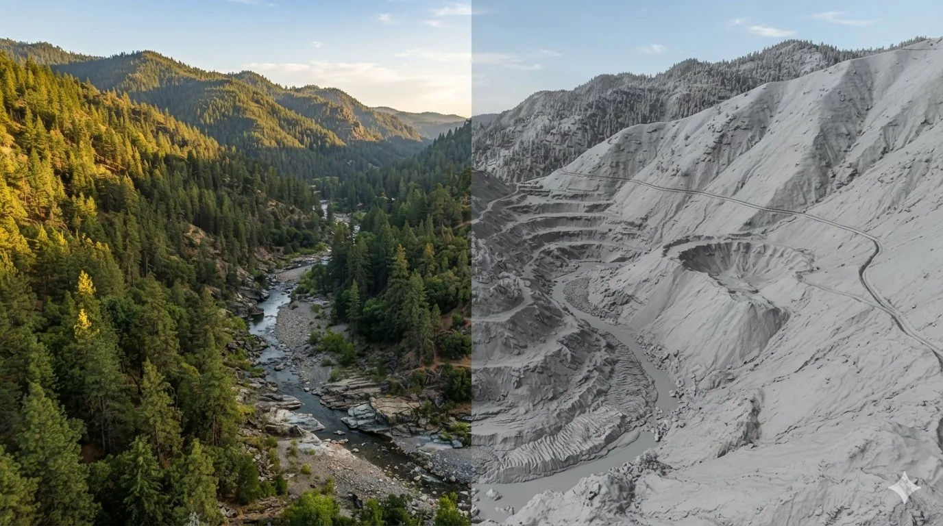
Most of us learned to read ground the slow way. You walk a drainage, you look at the bank cuts, you notice where the gravel changes, and over a few seasons you start to build a picture of what the water did before you got there. That still matters. But there is a tool now that lets you see the shape of the ground before you ever put a boot on it, and it is free, public, and good enough to spot a hand-dug ditch under a hundred years of brush.
That tool is LiDAR.
What LiDAR actually is
LiDAR stands for Light Detection and Ranging. An aircraft flies a grid pattern over the landscape with a laser scanner mounted underneath. The scanner fires pulses of light at the ground, hundreds of thousands per second, and measures how long each pulse takes to bounce back. Time multiplied by the speed of light gives you distance. Combine that with the aircraft's exact position and orientation, and every returned pulse becomes a point in three dimensional space with a known elevation.
Do that across a whole county and you end up with a point cloud containing billions of measurements. That is the raw product.
The part that matters: bare earth
Here is the piece that makes LiDAR useful to us instead of just interesting.
When a pulse hits a tree, some of the light reflects off the top of the canopy, some off branches partway down, and some slips through the gaps and reaches actual dirt before bouncing back. Processing software sorts those returns and keeps the ones that hit the ground. What remains is a bare earth model, meaning the terrain with the vegetation stripped away.
The USGS 3D Elevation Program collects this data nationwide and gives it away at no cost and with no use restrictions. Their standard one meter digital elevation model is produced exclusively from high resolution LiDAR, and the elevations in it represent the bare earth surface. One meter resolution means one elevation value for every square meter of ground.
For comparison, the older USGS elevation data that most mapping apps still use is roughly ten meters per cell. At ten meters, a six foot deep ditch does not exist. At one meter, it is obvious.
USGS has also started publishing a seamless one meter product that blends the individual flight projects together, which cleans up the mismatched edges you sometimes see where two survey areas meet.
Why it works on old workings
The reason LiDAR is such a good fit for our hobby is that almost everything we care about has topographic expression. It sticks up or it dents in.
Archaeologists figured this out first. Research on LiDAR survey under forest canopy showed it could reveal features that pedestrian survey and aerial photography had missed for decades, and a study in the upper Great Lakes demonstrated that even small pits dug by mobile hunter gatherers show up in the data. If the technique can find a food storage pit from AD 1200, it can certainly find a hydraulic pit from 1855.
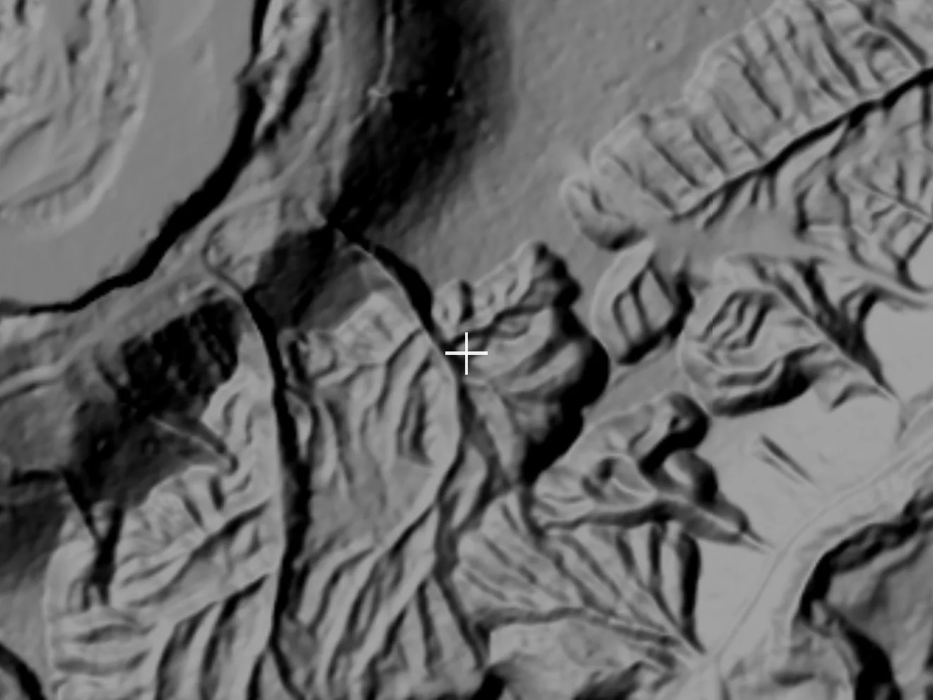
Here is the same ground both ways. Drag the divider.
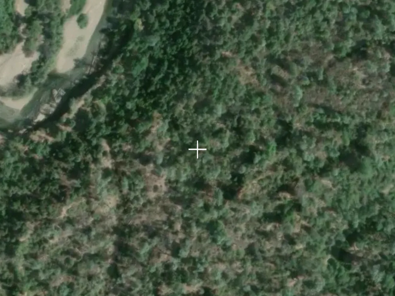
 SATELLITE
LiDAR
SATELLITE
LiDAR
Reading LiDAR for gold
What I look for, in rough order of usefulness:
Benches and terraces. Flat shelves standing above the modern creek are old channel levels. The water ran there once, and it dropped gold there. On a shaded relief LiDAR map they read as clean horizontal steps in the hillside, and you can trace them for a mile.
Hydraulic pits and cuts. The old timers moved absurd volumes of material. A worked hillside has a scalloped, unnatural face with a flat washed floor below it. Nothing in nature makes that shape.
Ditch lines. Water ditches were dug on a slight consistent grade to feed hydraulic operations, and they run for miles across slopes, cutting straight across contours in a way no natural drainage does. Follow a ditch and it takes you to where the water was going, which is where the gold was.
Tailings piles. Dredge tailings show up as unmistakable ripples. Hand stacked cobble piles show as small mounds clustered near a channel.
Drainage detail. At one meter you can see the tiny feeder gullies and inside bends that never appear on a standard topo. Those are the collection points.
Bedrock structure. Exposed ledges, false bedrock rises, and slate bars running crossways to the flow all read as texture in the hillshade.
Reading LiDAR for coins and relics
Same principle, different targets. You are hunting the places people lived, worked, and traveled.
Old roadbeds and wagon routes. Abandoned roads survive as a shallow linear depression with a berm on the downhill side, often persisting long after the brush swallowed them. Where an old road crosses a creek, there was a ford or a bridge, and people lost things at both.
Cabin sites and cellar holes. A rectangular depression, a leveled pad cut into a slope, or a low rectangular rubble outline. Camps and cabins mean coins, buttons, tobacco tins, and tools.
Terraced flats near water. Mining camps and homesteads clustered on the first flat ground above the high water line.
Railroad grades and mill sites. Grades read as long ruler straight embankments. Mill sites read as large leveled benches with foundation shapes on them.
Orchard rows and fence lines. Faint parallel ridges tell you a homestead sat nearby even when nothing is standing.
The workflow I use is simple. Find the shape in LiDAR, cross check it against a historic topo or a mining record, mark a waypoint, then go swing over it. It saves an enormous amount of walking.
What LiDAR will not do
It does not see metal, and it does not see gold. It sees shape.
It does not see features that were never expressed in the ground surface, or that have been graded flat since.
It struggles where the canopy is so dense that almost no pulses reach dirt, and in a few areas it struggles because nobody has flown that ground yet. Coverage is good and improving but it is not universal.
It is also a snapshot from whatever year the flight happened, so recent road work or reclamation may not appear.
One legal note
Finding an old site is not the same as being allowed to dig it. On federal land, the Archaeological Resources Protection Act (16 U.S.C. 470aa to 470mm) protects archaeological resources, and material generally 100 years old or older falls under that protection. National Parks prohibit metal detecting outright. Mining claims are private property rights even when the surface is public. Historic townsites, cabins, and mining structures on public land are usually off limits to collecting.
Check with the managing BLM field office or Forest Service ranger district before you dig, every time. LiDAR finds you a lot of sites, and some of them are sites you are legally required to leave alone.
Using it in the app
Gold Prospector serves a one meter LiDAR hillshade layer built from USGS 3DEP data, rendered as a map layer you can toggle on and fade with an opacity slider so you can blend it against satellite imagery, claims, streams, and historic mine points. That combination is the whole trick. LiDAR tells you the shape of the ground, the other layers tell you what the shape means, and your detector or your pan tells you whether you were right.
Sources & Citations
- U.S. Geological Survey, About 3DEP Products and Services
- USGS, 1 Meter Digital Elevation Models, National Map 3DEP Downloadable Data Collection
- USGS, 3D Elevation Program Standards and Specifications
- USGS, Seamless 1 Meter Digital Elevation Model (S1M)
- USGS, 3D Elevation Program FAQs
- Howey, M.C.L., et al., Detecting Precontact Anthropogenic Microtopographic Features in a Forested Landscape with Lidar, PLOS ONE
- Archaeological Resources Protection Act of 1979, 16 U.S.C. 470aa to 470mm